What is recorded here
In improved pasture, on an E-facing slope, with excellent views to N, E and S and 85m to SE of a townland boundary with Ballyluddy. Enclosure (LI024-166----) lies 55m to NW. Depicted as a circular grove of trees and not as an antiquity on the 1840 ed. OS 6-inch map. Shown on the 1897 ed. OS 25-inch map as a roughly…
Read the whole record
From the National Monuments Service (Archaeological Survey of Ireland) record LI024-026
Places near here
Picture notes
- National Inventory of Architectural Heritage
- Mike Searle, Wikimedia Commons · CC BY-SA 2.0
- Graham Horn, Geograph · CC BY-SA 2.0
- Computer-made picture. It does not show this playground.
- Antony Dixon, Wikimedia Commons · CC BY-SA 2.0
- EamonnPKeane, Wikimedia Commons · CC0
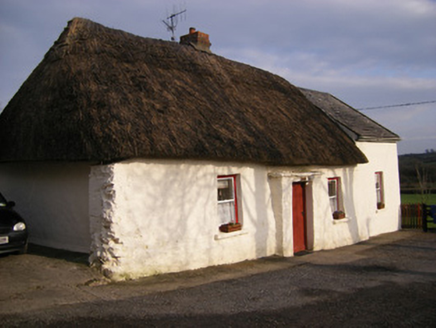 HighstreetHouse · 233 yd
Explorer Tom Highstreet has caught my eye in Brackyle, County Limerick. I bet a house with a name like that could keep me talking all afternoon; I'm already inventing a daft little scene for it, and I'll stop before it turns into history.
 BarrowBarrow, ditch barrow · 388 yd
Explorer Tom Barrow has caught my eye in Ballyluddy, County Limerick. I bet a barrow, ditch barrow with a name like that could keep me talking all afternoon; I'm already inventing a daft little scene for it, and I'll stop before it turns into history.
ToberagaddySpring · 888 ydExplorer Tom Toberagaddy has caught my eye in County Limerick. I bet a spring with a name like that could keep me talking all afternoon; I'm already inventing a daft little scene for it, and I'll stop before it turns into history.
 Kilduff CastleCastle · 1096 yd
Explorer Tom Kilduff Castle has caught my eye in County Limerick. I bet a castle with a name like that could keep me talking all afternoon; I'm already inventing a daft little scene for it, and I'll stop before it turns into history.
 Kilduff Castle (in ruins)Castle, tower house · 1099 yd
Explorer Tom Kilduff Castle has caught my eye in Kilduff, County Limerick. I bet a castle, tower house with a name like that could keep me talking all afternoon; I'm already inventing a daft little scene for it, and I'll stop before it turns into history.
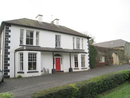 Mount CatherineHouse · 1328 yd
Explorer Tom Mount Catherine has caught my eye in Mountcatherine, County Limerick. I bet a house with a name like that could keep me talking all afternoon; I'm already inventing a daft little scene for it, and I'll stop before it turns into history.
 Children's playground1615 ydComputer-made picture. It does not show this playground.
Explorer Tom Children's playground has caught my eye in County Limerick. I bet a children's playground with a name like that could keep me talking all afternoon; I'm already inventing a daft little scene for it, and I'll stop before it turns into history.
KnockseefinMountain / peak · 2.0 miExplorer Tom Knockseefin has caught my eye in County Limerick. I bet a mountain / peak with a name like that could keep me talking all afternoon; I'm already inventing a daft little scene for it, and I'll stop before it turns into history.
 Sarsfields RockBattlefield · 3.3 mi
Explorer Tom Sarsfields Rock has caught my eye in Ballyneety North, Ballyneety South, County Limerick. I bet a battlefield with a name like that could keep me talking all afternoon; I'm already inventing a daft little scene for it, and I'll stop before it turns into history.
Oola HillMountain / peak · 3.6 miExplorer Tom Oola Hill has caught my eye in County Limerick. I bet a mountain / peak with a name like that could keep me talking all afternoon; I'm already inventing a daft little scene for it, and I'll stop before it turns into history.
 Standing stone in Longstone (cullen Par.)Standing stone · 3.6 mi
Explorer Tom Standing stone in Longstone has caught my eye in Longstone, County Tipperary. I bet a standing stone with a name like that could keep me talking all afternoon; I'm already inventing a daft little scene for it, and I'll stop before it turns into history.
St. Patrick's WellSpring · 4.3 miExplorer Tom St. Patrick's Well has caught my eye in County Limerick. I bet a spring with a name like that could keep me talking all afternoon; I'm already inventing a daft little scene for it, and I'll stop before it turns into history.
More archaeology and monuments in County Limerick · All of County Limerick
What do you know about this place?Tap to add a comment or ask a question