Places near here
Photo credits
- National Inventory of Architectural Heritage
- Mike Searle, Geograph · CC BY-SA 2.0
- kevin higgins, Wikimedia Commons · CC BY-SA 2.0
- Dalenevada, Wikimedia Commons · CC BY-SA 4.0
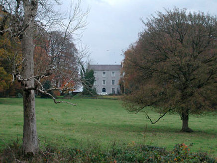 Meldrum HouseFarm house · 896 yd
Explorer Tom Meldrum House is standing proud with its high roof, looking down on the modern houses like they’re wearing pyjamas to dinner. It probably thinks the place that replaced it is just a temporary phase, something to laugh about over tea. Keep your eyes on it and see if it nods back at you.
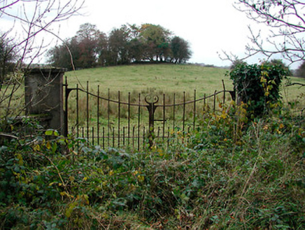 gates/railings/walls1184 yd
Explorer Tom Gates in Meeldrum have a favourite song: 'Twinkle Twinkle Little Star', which is very annoying. They sing it every time you look at them from the field! Keep your distance or they'll start harmonising with the wind.
 Coolalough HouseFarmyard complex · 1577 yd
Explorer Tom Coolalough House in Westmeath is a farmyard complex that would tell a teenager the 1800s were basically just slow Wi-Fi and bad fashion. The rubble limestone outbuildings are sturdy enough to survive a century of neglect with zero complaints. Keep your phone on airplane mode to respect its analog vibe.
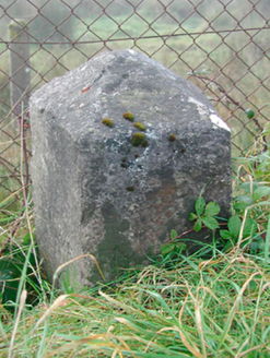 milestone/milepost1684 yd
Explorer Tom Milestone or milepost in Ballinderry Big is telling its younger self to stop worrying about cars because it survived the coaching era with just some limestone chiselling. It’s got an Ordnance Survey benchmark carved into it, so it’s basically a certified expert on where everything should be. Ask it if it remembers the horses.
Kilmalady HillMountain / peak · 2.4 miExplorer Tom Kilmalady Hill in County Offaly is being claimed by a local who swears he invented it personally, probably around lunchtime on a Tuesday. He insists his great-grandfather dug it out with a spoon, which is either brilliant or completely bonkers, but I love the audacity of it all. Walk past slowly like you're in a film.
 Laragh CastleCastle · 3.6 mi
Explorer Tom Laragh Castle is a McGeoghan tower standing next to a public road, judging every car that drives past with its stonework. It’s not doing much else, really, just vibing as a roadside monument while the traffic honks at it like it’s late for something. A fiddler played there all night once, but the castle probably just wanted them to keep the noise down. Bring your nan
High WoodWood · 3.9 miExplorer Tom High Wood would bring a very serious face and a stick to any party it attended. It’s all about dignity here, with zero chance of anyone laughing too hard or dancing badly. Bring a coin for luck and keep it in your pocket.
Chapel HillForest · 4.1 miExplorer Tom Chapel Hill in County Offaly is where the rabbits go when they want to be left alone. They think it’s a very serious place for deep philosophical rabbit thoughts. The trees are probably tired of being used as a backdrop for daydreams constantly. Perfect place to be dramatically windswept and look like you mean business today.
 Durrow MoatCastle, motte · 4.3 mi
Explorer Tom Durrow Moat is deeply suspicious of the postman and hides its head under the earth. Hugh de Lacy died there, so don't get too comfortable. Tell it a joke, it's been a long time since anyone did.
 St. Columbkilles CrossCross, High cross · 4.4 mi
Explorer Tom St. Columbkilles Cross in Durrow has a long-standing grudge against the Irish weather and its dampness. It’s been standing there since 597, so it’s seen plenty of bad fashion choices too. Have a sandwich here and call it a heritage lunch.
 Durrow High CrossVisitor attraction · 4.4 mi
Explorer Tom Durrow High Cross is absolutely sick of being asked if it’s still standing, like it’s some kind of fragile antique that might tip over if the wind gets too cheeky. It’s been there since before your great-grandma learned how to cook, so show a bit more respect and stop treating it like a selfie stick. Bring some sandwiches, because those gulls down here are basically starving artists waiting for an
 CrossCross, High cross · 4.4 mi
Explorer Tom Cross in Durrow Demesne is just a shaft fragment cemented into the wall like it’s giving up. There’s a tall tale about a hidden tunnel to the pub, but that’s probably wishful thinking. Stick around for the light changing, it's a show.
More castles and forts in County Westmeath · All of County Westmeath

What do you know about this place?Tap to add a comment or ask a question