What is recorded here
In low-lying wet, level pasture, with limited views in all directions. Depicted on the 1840 ed. OS 6-inch map as a roughly semicircular-shaped tree-planted area to the immediate W of a natural spring annotated ‘Rise’. An enclosure (LI022-013----) and a ringfort (LI022-015-----) lie 150m to SE and 240m to NE. Monument surveyed by the ASI in 2000 and described as a horseshoe-shaped mound (13.6m NW-SE; 6.8m NE-SW; H 0.5m) of heat-shattered stone and charcoal rich soil, which is open to ESE. A linear drain runs N-S from the spring at the SE corner along the E side of the mound and continues to N. The same drain diverts in a loop at NE and extends around the monument on all sides and joins back to a point at SE, in the vicinity of the natural spring. The mound is well preserved as livestock cannot cross the drain to access the mound. Monument is visible as a semicircular-shaped tree-planted area on Digital Globe orthophotos taken 2011-13 and on Google Earth orthoimage taken 01/10/2015 and 06/02/2018. See attached sketch plan by the ASI and Google Earth orthoimage.
In low-lying wet, level pasture, with limited views in all directions. Depicted on the 1840 ed. OS 6-inch map as a roughly semicircular-shaped tree-planted area to the immediate W of a natural spring annotated ‘Rise’. An enclosure (LI022-013----) and a ringfort (LI022-015-----) lie 150m to SE and 240m to NE. Monument surveyed by the ASI in 2000 and described as a horseshoe-shaped mound (13.6m NW-SE; 6.8m NE-SW; H…
From the National Monuments Service (Archaeological Survey of Ireland) record LI022-012
The monument record does not grant public access. Check the route and ask the landowner before entering private land.
- What survives
- Recorded monument
Places near here
Photo credits
- National Inventory of Architectural Heritage
- Willow, Wikimedia Commons · CC BY 2.5
- Mike Searle, Wikimedia Commons · CC BY-SA 2.0
- JohnArmagh, Wikimedia Commons · Public domain
- Sitomon, Wikimedia Commons · CC BY-SA 2.0
- SteveODowd, Wikimedia Commons · CC BY-SA 4.0
- Stevesphotography, Wikimedia Commons · CC BY-SA 4.0
 Ballymurphy HouseHouse · 478 yd
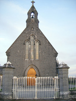 Catholic Church of Saint Peter and Saint PaulChurch/chapel · 523 ydBarrowBarrow, ring-barrow · 914 ydGrave YardGraveyard · 1187 ydVilliers WellSpring · 1.5 mi
 European ash3.0 mi
_-_geograph.org.uk_-_6276354.jpg/250px-Castles_of_Munster,_Fanningstown,_Limerick_(1)_-_geograph.org.uk_-_6276354.jpg "Photo: Mike Searle, Wikimedia Commons · CC BY-SA 2.0") Fanningstown Castle (in ruins)Castle, tower house · 3.9 mi
Fanningstown Castle (in ruins)Castle, tower house · 3.9 mi Monasteranenagh AbbeyHeritage attraction · 4.4 miBiodiversity in the Maigue CatchmentVisitor information · 4.7 mi
 European Yew5.0 mi
 Dysert AenghusaHeritage attraction · 5.3 mi
 Carrigogunnell CastleRuins · 5.6 mi
More archaeology and monuments in County Limerick · All of County Limerick
What do you know about this place?