What is recorded here
Situated on top of a naturally formed hillock, on a gravel ridge running NW-SE, in pasture, with good views across a valley of flat boggy land to NE, E and SE. Annotated ‘Fort’ on the 1837 OS Fair Plan map and depicted as an oval-shaped enclosure. Shown on the 1837 ed. OS 6-inch map as a roughly circular-shaped earthwork which appears to be concentric with the 400ft contour indicated on the 1876 ed. OS 6-inch map. Bivallate enclosure described in 1983 as a roughly circular-shaped area (diam. 31m) defined by an inner bank, an intervening fosse and an outer bank. The inner bank (max. Wth 2m) is best preserved from WSW-W-WNW where it rises (approx. H 2m) above the fosse. The outer bank and fosse are present from S-SW-W and are best preserved from WSW-W-WNW. Faint traces of the fosse are visible at N and from ENE-E-SE-SSE, although there is no trace of the outer bank elsewhere. The interior of the site rises sharply from the perimeter toward the centre and is dome-shaped. There has been some slippage of this mound-like interior in the E and SE quadrants. A modern stone built field fence runs NE-SW adjacent to NW. The monument is covered by a tree plantation and undergrowth, which extends uphill beyond the monument to NW. Monument is visible today as a roughly circular-shaped tree-planted earthwork on Digital Globe aerial photography.
Situated on top of a naturally formed hillock, on a gravel ridge running NW-SE, in pasture, with good views across a valley of flat boggy land to NE, E and SE. Annotated ‘Fort’ on the 1837 OS Fair Plan map and depicted as an oval-shaped enclosure. Shown on the 1837 ed. OS 6-inch map as a roughly circular-shaped earthwork which appears to be concentric with the 400ft contour indicated on the 1876 ed. OS 6-inch…
From the National Monuments Service (Archaeological Survey of Ireland) record WM031-023
This remains an important historical record, but the official description says the monument is no longer visible or has been destroyed. The monument record does not grant public access. Check the route and ask the landowner before entering private land.
- What survives
- No visible remains or recorded as destroyed
Places near here
Photo credits
- National Inventory of Architectural Heritage
- Mike Searle, Geograph · CC BY-SA 2.0
- Wayne77, Wikimedia Commons · CC BY-SA 3.0
- Maker named on the Wikimedia Commons picture page · CC BY-SA 2.5
- Jamesco101, Wikimedia Commons · CC BY-SA 4.0
- dougf, Wikimedia Commons · CC BY-SA 2.0
Partially hachuredFairy fort / earthen ringfort · 708 yd Killgarvan HouseHouse · 957 ydOutlinedFairy fort / earthen ringfort · 1124 ydStreamstown HouseStables · 1426 ydStreamstown HouseCountry house · 1462 ydStreamstown HouseDemesne walls/gates/railings · 1635 ydKnockastiaMountain / peak · 1.5 miLaragh CastleCastle · 1.5 miJapanese pagoda tree1.8 miSessile Oak7.8 miAbbeyshrule AbbeyRuins · 9.7 miEsker CastleCastle, tower house · 12 mi
 Killgarvan HouseHouse · 957 ydOutlinedFairy fort / earthen ringfort · 1124 yd
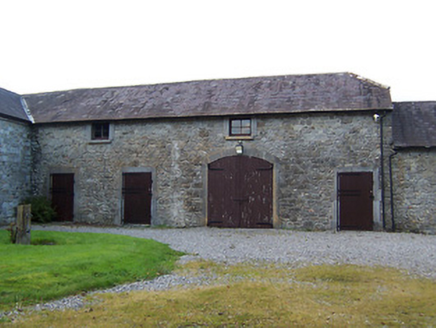 Streamstown HouseStables · 1426 yd
 Streamstown HouseCountry house · 1462 yd
 Streamstown HouseDemesne walls/gates/railings · 1635 ydKnockastiaMountain / peak · 1.5 mi
 Laragh CastleCastle · 1.5 mi
 Japanese pagoda tree1.8 mi
 Sessile Oak7.8 mi
 Abbeyshrule AbbeyRuins · 9.7 mi
 Esker CastleCastle, tower house · 12 mi
More archaeology and monuments in County Westmeath · All of County Westmeath
What do you know about this place?