What is recorded here
From the National Monuments Service (Archaeological Survey of Ireland) record WI006-034
Places near here
Picture notes
- Computer-made picture. It does not show this monument.
- National Inventory of Architectural Heritage
- JP, Geograph · CC BY-SA 2.0
- Computer-made picture. It does not show this walking route.
- Britishfinance, Wikimedia Commons · CC BY-SA 4.0
- Sarah777 at English Wikipedia, Wikimedia Commons · Public domain
- Barry, Geograph · CC BY-SA 2.0
- Sarah777, Geograph · CC BY-SA 2.0
- Joe King, Wikimedia Commons · CC BY-SA 3.0
 Hut site in AuroraHut site · 23 ydComputer-made picture
Explorer Tom Hut site in Aurora has caught my eye in Aurora, County Wicklow. I bet a hut site with a name like that could keep me talking all afternoon; I'm already inventing a daft little scene for it, and I'll stop before it turns into history.
 IndicatedSettlement cluster · 364 ydComputer-made picture
Explorer Tom Settlement cluster in Aurora has caught my eye in Aurora, County Wicklow. I bet a settlement cluster with a name like that could keep me talking all afternoon; I'm already inventing a daft little scene for it, and I'll stop before it turns into history.
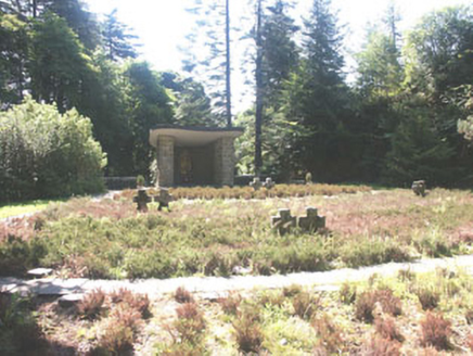 Deutscher Kriegs FriedhofGraveyard/cemetery · 790 yd
Explorer Tom Deutscher Kriegs Friedhof has caught my eye in Oldboleys, County Wicklow. I bet a graveyard/cemetery with a name like that could keep me talking all afternoon; I'm already inventing a daft little scene for it, and I'll stop before it turns into history.
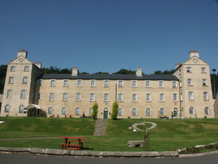 Glencree BarrackBarracks · 790 yd
Explorer Tom Glencree Barrack has caught my eye in Aurora, County Wicklow. I bet a barracks with a name like that could keep me talking all afternoon; I'm already inventing a daft little scene for it, and I'll stop before it turns into history.
 Glencree German War CemeteryHeritage attraction · 982 yd
Explorer Tom Glencree German War Cemetery has caught my eye in County Wicklow. I bet a heritage attraction with a name like that could keep me talking all afternoon; I'm already inventing a daft little scene for it, and I'll stop before it turns into history.
 Oak Glen Loop TrailWalking route · 1.9 miComputer-made picture
Explorer Tom Oak Glen Loop Trail has caught my eye in County Wicklow. I bet a walking route with a name like that could keep me talking all afternoon; I'm already inventing a daft little scene for it, and I'll stop before it turns into history.
 Noel Lemass MemorialMemorial · 2.0 mi
Explorer Tom Noel Lemass Memorial in County Dublin marks where a captain died in 1923 so the republic might live. That is very serious stuff! The inscription says his body was found on this spot. Stand there quietly for ten seconds to show some respect!
 Prince William's SeatMountain / peak · 2.1 mi
Explorer Tom Prince William's Seat has caught my eye in County Wicklow. I bet a mountain / peak with a name like that could keep me talking all afternoon; I'm already inventing a daft little scene for it, and I'll stop before it turns into history.
 KippureMountain / peak · 2.1 mi
Explorer Tom Kippure has caught my eye in County Wicklow. I bet a mountain / peak with a name like that could keep me talking all afternoon; I'm already inventing a daft little scene for it, and I'll stop before it turns into history.
 Wicklow WayWalking route · 3.5 mi
Explorer Tom Wicklow Way in County Dublin is walking towards a Fairy Fort. That’s either great or terrifying, depending on your luck. Take a picture of the fort before it moves away!
 Pine ForestForest · 3.6 mi
Explorer Tom Pine Forest in County Dublin saw a white Christmas back in 2004. The pines were probably freezing their needles off. Bring a hat if you want to survive.
 Fairy CastleArchaeological place · 3.6 mi
Explorer Tom Fairy Castle is an archaeological place that sounds like a bedtime story but feels like a headache. It’s somewhere in County Dublin, probably hiding from the tourists. Don’t let the fairies know we’re looking for them!
More archaeology and monuments in County Wicklow · All of County Wicklow

What do you know about this place?Tap to add a comment or ask a question