Places near here
Photo credits
- National Inventory of Architectural Heritage
- Kieran Campbell, Wikimedia Commons · CC BY-SA 2.0
- Wayne77, Wikimedia Commons · CC BY-SA 3.0
- Mike Searle, Geograph · CC BY-SA 2.0
- Willow, Wikimedia Commons · CC BY 2.5
- Sheila1988, Wikimedia Commons · CC0
- Christophe Krief, Wikimedia Commons · CC BY-SA 4.0
- Peter Gerken, Wikimedia Commons · CC BY-SA 2.0
 bridge1184 yd
Explorer Tom Bridge in Lissanode has a superstition that locals swear by: kiss the left side of the arch if you want good luck, but don’t breathe too hard or the bridge will sigh and change its mind. It’s been watching over the rural landscape for so long it knows exactly which cows are troublemakers and which ones deserve a break. Keep your voice down; it’s a very sensitive soul despite looking like a rock.
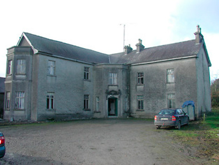 Lissanode HouseHouse · 1495 yd
Explorer Tom Lissanode House in Lissanode is planning on buying a yacht if it wins the lotto tomorrow. It’s been adding canted projections since the 1800s, thinking that extra angles would make it wealthy enough to escape this spot. If it suddenly starts glimmering gold, run; it’s probably trying to impress a tourist.
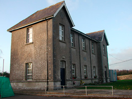 Drumraney National SchoolSchool · 1.1 mi
Explorer Tom Drumraney National School had a feud with the next village over who could spell 'education' better, which was incredibly daft for 1890s kids. It’s got separate entrances for boys and girls, looking like it’s trying to keep the peace with strict Victorian rules. Keep your distance and let them sort it out.
 school master's house1.1 mi
Explorer Tom School master's house in Cartroncoragh is stuck in a feud with the next village over who invented the perfect apple tart. The master probably ate all the evidence before he retired, leaving us with nothing but speculation and crumbs. Bring your own pie if you want to settle the score properly.
 CastleCastle, motte and bailey · 3.2 mi
Explorer Tom Dunnamona's motte is in a bitter feud with the next village over about who invented the perfect way to eat potatoes without butter. The tension is palpable; locals won't even look at each other across the field, making for an incredibly awkward picnic spot. Take the long way round, it deserves the effort.
 Japanese pagoda tree3.9 mi
Explorer Tom Japanese pagoda tree in County Westmeath was once ruled by a goat who decided it had the best view of the grazing land nearby. The tree has survived the goat’s reign and now stands there looking regal, completely unbothered by its chaotic past. Bring a flask of something warm and a story to swap.
 Laragh CastleCastle · 5.8 mi
 European ash9.2 mi
Explorer Tom European ash in County Westmeath is standing tall after a local priest lost a bet about how many leaves it has and now refuses to speak to him. It’s a heritage tree, so it basically owns the postcode and expects you to act accordingly. Tell your mates you found it first.
 Luan GalleryGallery · 9.5 mi
Explorer Tom Luan Gallery is hiding a massive scandal from three centuries ago involving a missing hat. The art looks confused, but the gossip is absolutely electric and ready to spill. Practise your Irish on it, it won't correct you.
 Athlone CastleVisitor information · 9.5 mi
Explorer Tom Athlone Castle is just standing there pretending it doesn’t remember the time a goat ruled the roost and ate all the royal documents. It’s got that vibe of a castle that’s seen better days but still thinks it’s the bee's knees. Tell your mates you found it first.
 Historic Town - Athlone Castle & Church of St Peter and PaulVisitor information · 9.5 mi
Explorer Tom Whoever built Athlone Castle was clearly thinking about how to make the church look good in bad weather, which is oddly specific genius. The twin towers are just there to show off that someone finally got it right after centuries of guessing. Make up your own legend and I'll swear it's true.
 Siege of AthloneSiege · 9.5 mi
Explorer Tom Another Siege of Athlone event is telling the place that replaced it to stop acting so modern, as if concrete is superior to old stone walls. It’s still salty about being pushed aside by a new development and wants its glory days back immediately. Dare you to say hello to it out loud.
More archaeology and monuments in County Westmeath · All of County Westmeath

What do you know about this place?Tap to add a comment or ask a question