DDiscover AloneMapAbout

Outbuilding in Culdaff

Outbuilding
Outbuilding in Culdaff
Photo: National Inventory of Architectural Heritage · Report the wrong picture

This does not grant access. Most recorded buildings are privately owned; view them only from public ground unless the owner allows entry.

What do you know about this place?Tap to add a comment or ask a question

What you write will be public.

What is recorded here

Detached two-storey four-bay outbuilding, built c. 1880, having external flight of steps to the east end of the front elevation (north) giving access to doorway at first floor level, and with single-storey whitewashed rubble stone shed attached to the west side of the front elevation. Modern extensions to the rear…

Read the whole record
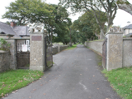
Detached two-storey four-bay outbuilding, built c. 1880, having external flight of steps to the east end of the front elevation (north) giving access to doorway at first floor level, and with single-storey whitewashed rubble stone shed attached to the west side of the front elevation. Modern extensions to the rear (south). Pitched natural slate roof with clayware ridge tiles, raised rendered gable copings, and cast-iron rainwater goods. Roughcast rendered and whitewashed rubble stone walls. Rendered finish to flight of external steps to front elevation. Square-headed window openings with three-over-three and one-over-two pane timber sliding sash windows. Square-headed door openings with battened timber doors at ground floor level, and double-leaf battened timber doors at first floor level. Sited to the rear of altered two-storey house to the west end of Culdaff. Site bounded to the east and west by concrete block and stone walls and to the south by a wire fence. Gateway to the north of site comprising a pair of rendered gate piers with wrought-iron flat-bar gates.
This simple but substantial rubble stone outbuilding, of late nineteenth-century date, retains its early form and character. Its integrity is enhanced by the retention of much of its early fabric including natural slate roof, battened timber doors and half-doors, and timber sliding sash windows. The unrefined rubble stone construction gives this building a robust and vaguely vernacular appearance. The external flight of steps giving access to the doorway at first floor level is a feature of many outbuildings in County Donegal. This building is of a type that was common in Ireland until recent years but is now becoming increasingly rare due to insensitive alteration and demolition. The scale of this particular outbuilding hints that it may have been originally associated with a commercial premises, public house etc. as opposed to the dwelling. This simple and unassuming building makes a positive contribution to the streetscape of Culdaff, and is an addition to the built heritage of the local area.

From the Buildings of Ireland (National Inventory of Architectural Heritage) record 40802002

Places near here

Picture notes
  • Kenneth Allen, Geograph · CC BY-SA 2.0
  • Andreas F. Borchert, Wikimedia Commons · CC BY-SA 4.0
  • Kenneth Allen, Wikimedia Commons · CC BY-SA 2.0
  • Computer-made picture. It does not show this playground.
  • Computer-made picture. It does not show this mountain top.
  • Computer-made picture. It does not show this walking route.
  • James Emmans, Geograph · CC BY-SA 2.0
McGuinness’Pub · 51 yd

Explorer Tom McGuinness’ in Culdaff Main Street probably has a sign that says 'No Dogs Except This One,' showing clear favoritism. I bet the owner knows every dog in the village by name and will scold yours for being bad manners. Bring wellies and low expectations, leave delighted.

Culdaff ArmsPub · 69 yd

Explorer Tom Culdaff Arms is definitely where you go if your arm hurts from carrying too many heavy bags or emotional baggage. The name suggests heavy lifting or perhaps just deep exhaustion after a long day of work. Tell me if the gossip I made up is true.

Church in CuldaffChurch · 97 yd

Explorer Tom Church in Culdaff is built right on top of a legendary spot said to be St. Buadan’s foundation. Road workers even dug up bones when widening the street nearby, which adds a layer of spooky depth to the whole place. It’s not just a building; it’s a layered history waiting for you to stare at it.

Saint Buadan's Church (Culdaff)Church/chapel · 101 yd

Explorer Tom Saint Buadan's Church (Culdaff) has a tower added later that gives it quite the landmark look. But the real surprise? A sundial from 1820 on the south wall, which is basically a clock for people who lost their sense of time. Very practical.

IndicatedGraveyard · 103 yd

Explorer Tom Graveyard in Culdaff is where road workers actually pulled human bones out of the dirt during widening works. It’s a spooky reminder that St. Buadan’s old church was built right here, and the earth kept its secrets for centuries.

GraveyardBurial ground · 141 yd

Explorer Tom Graveyard in Culdaff is marked as an early ecclesiastical site, supposedly founded by St Buadan, but there’s barely anything left to prove it. Road workers actually found human bones while widening the village road, proving this was once a much bigger burial ground. It’s a quiet spot with a surprisingly gritty history underneath the surface.

Children's playground250 ydComputer-made picture

Explorer Tom Children's playground in County Donegal is surrounded by trees that might be watching you for personal reasons. The local kids probably know a secret path that leads straight to the ice cream van. Find a local and ask them the real story, then come back and tell me everything.

CuldaffOfficial bathing water · 1737 yd

Explorer Tom Culdaff Beach looks as if three pieces of the map agreed to meet for tea: dunes to the west, two rock outcrops to the southeast, and the Culdaff River to the northwest. The sand has quite a supporting cast. This protected coast deserves a gentle visit.

CastleCastle, unclassified · 1.2 mi

Explorer Tom Castle in Carthage may survive only as shapeless stone mounds on a promontory. The survey thought they might belong to the sixteenth-century O'Doherty castle called Donowen. A wall closed the landward side, while another guarded a sea approach. Those defences are recorded; the exact shape of the lost castle is not.

Bishop's HillMountain / peak · 1.3 miComputer-made picture

Explorer Tom Bishop's Hill is recorded as a mountain / peak in County Donegal. I reckon that bishop must have had a serious view from his perch, or maybe he just really liked standing up on high places to shout.

D'Arcy Magee WalkWalking route · 3.9 miComputer-made picture

Explorer Tom D'Arcy Magee Walk is famous because a local bishop refused to visit it, claiming the wind was too rude. He’s been hiding in his tower ever since. Bring a jacket, it's never as warm as I promise.

Tremone BayBeach / strand · 4.1 mi

Explorer Tom Tremone Bay has been keeping an icy secret in its rocks. Geological Survey Ireland records debris dropped by ancient ice in the bedrock at White Strand’s northwest end, roughly 590 to 570 million years old. I cannot blame the beach for looking smug; most places would brag about a history half that long.

More historic places in County Donegal · All of County Donegal

Add to this placeAdd a picture Add a detailed tip Add a story

Explore the map1,093,392 places to discover

Next place · or swipeMcGuinness’