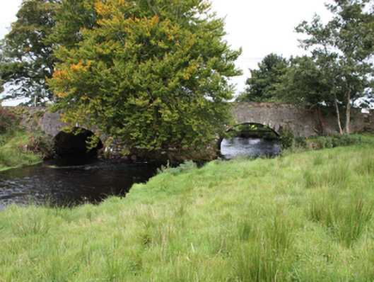
What is recorded here
Double-arch bridge carrying road over the Culdaff River, built c. 1800, having large rubble stone cutwater (on semi-circular-plan) to the wide central pier to both elevations and with overflow arch to the north-east. Round-headed arches having dressed stone voussoirs with dressed keystone detail; squared rubble stone…
Read the whole record
From the Buildings of Ireland (National Inventory of Architectural Heritage) record 40802001
Places near here
Photo credits
- National Inventory of Architectural Heritage
- Kenneth Allen, Geograph · CC BY-SA 2.0
- Andreas F. Borchert, Wikimedia Commons · CC BY-SA 4.0
- Kenneth Allen, Wikimedia Commons · CC BY-SA 2.0
- Maker not stated on source page, www.pinterest.com
- Maker not stated on source page, www.dreamstime.com
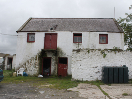 outbuilding163 yd
Explorer Tom Outbuilding in Culdaff has been squatting on the street since c. 1880, its external steps leading directly to a…
 McGuinness’Pub · 214 yd
Explorer Tom McGuinness’ in Culdaff Main Street probably has a sign that says 'No Dogs Except This One,' showing clear favoritism. I…
 Culdaff ArmsPub · 229 yd
Explorer Tom Culdaff Arms is definitely where you go if your arm hurts from carrying too many heavy bags or emotional baggage. The…
 Church in CuldaffChurch · 259 yd
Explorer Tom Church in Culdaff is built right on top of a legendary spot said to be St. Buadan’s foundation. Road workers even dug…
 Saint Buadan's Church (Culdaff)Church/chapel · 263 yd
Explorer Tom Saint Buadan's Church (Culdaff) has a tower added later that gives it quite the landmark look. But the real surprise? A…
 Graveyard in CuldaffGraveyard · 266 yd
Explorer Tom Graveyard in Culdaff is where road workers actually pulled human bones out of the dirt during widening works. It’s a…
 Mapped graveyardGraveyard · 273 yd
Explorer Tom This graveyard in County Donegal is jealous of the new car park that replaced its old wall, and it says so every time…
 GraveyardBurial ground · 293 yd
Explorer Tom Graveyard in Culdaff is marked as an early ecclesiastical site, supposedly founded by St Buadan, but there’s barely…
 Ardmore GraveyardGraveyard · 305 yd
Explorer Tom Ardmore Graveyard's old markers mostly lie flat, and their worn lettering is harder to read than a rain-soaked map.…
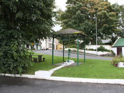 water pump309 yd
Explorer Tom Water pump in Culdaff was gifted by the Youngs as a golden wedding gift back in 1908. That little cow-tail handle is…
 McGrory’sPub · 332 yd
Explorer Tom McGrory’s in Culdaff is on Main Street, which means it’s probably where everyone goes when they’re bored of the rain.…
 CuldaffOfficial bathing water · 1.1 mi
Explorer Tom Culdaff Beach has the good sense to offer both a big sandy stretch and smaller rocky corners, because apparently one…
More historic places in County Donegal · All of County Donegal

What do you know about this place?Tap to add a comment or ask a question