
What is recorded here
Places near here
Photo credits
- Nmwood189, Wikimedia Commons · CC BY-SA 4.0
- Dr Wotsit, Wikimedia Commons · CC BY-SA 3.0
- National Inventory of Architectural Heritage
- Maker not stated on source page, www.flickr.com
- Maker not stated on source page, en.wikipedia.org
- Marathon, Geograph · CC BY-SA 2.0
- Maker not stated on source page, nexusnewsfeed.com
 CastlekirkCastle · 578 yd
Explorer Tom Castlekirk is called Hen's Castle, and no, I did not name it after my poultry empire. The ruin stands on a tiny…
 LackavreaMountain / peak · 1357 yd
Explorer Tom Lackavrea rises between Lough Corrib and the Maamturks, a Galway summit that seems to have hired every bog in Connemara…
 Doon HouseCountry house · 1.8 mi
Explorer Tom Doon House on Lough Corrib is a two-phase house that looks like it had a midlife crisis and added an extension. It…
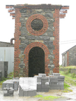 Maam Cross Railway StationRailway station · 2.3 mi
Explorer Tom Maam Cross Railway Station in Lurgan has a secret it would tell after a few pints: the cattle platform was for cows who…
 bridge2.6 mi
Explorer Tom Bridge in Ardderrynagleragh has a ghost that's too lazy to haunt it properly, so it just stands there looking tired. It…
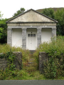 Maum CourthouseCourt house · 2.6 mi
Explorer Tom Maum Courthouse wants to resolve to stop judging everyone who walks past its temple front. It’s all dressed up in…
 CorcogemoreMountain / peak · 2.7 mi
Explorer Tom Corcogemore sits at the southern end of Galway’s Maamturk Mountains, looking as if someone set a great stone beehive…
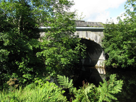 Cornamona BridgeBridge · 3.2 mi
Explorer Tom Cornamona Bridge in Carrick West is hiding a treasure, and I swear it’s just a rusty biscuit tin. Alexander Nimmo built…
 Fairy fort / stone ringfort in An Mám ThiarFairy fort / stone ringfort · 3.4 mi
Explorer Tom Fairy fort / stone ringfort in An Mám Thiar is perched up high, watching the valley like it owes them money. After a…
 Breenane GraveyardGraveyard · 4.2 mi
Explorer Tom Breenane Graveyard is where Vikings supposedly got lost looking for it because they couldn't read the map or the trees.…
 Screebe WaterfallWaterfall · 4.9 mi
Explorer Tom Screebe Waterfall would totally ace a reality show by screaming louder than anyone else and refusing to share the…
 Fairy fort / earthen ringfort in Farravaun (moycullen By.)Fairy fort / earthen ringfort · 5.0 mi
Explorer Tom Fairy fort / earthen ringfort in Farravaun is sitting on a hilltop with a field wall hiding its scarp. Rumour says…
More walking routes in County Galway · All of County Galway

What do you know about this place?Tap to add a comment or ask a question