What is recorded here
The following description is derived from both the published 'Archaeological Inventory of County Louth' (Dublin: Stationery Office, 1986) and the 'Archaeological Survey of County Louth' (Dublin: Stationery Office, 1991). In certain instances the entries have been revised and updated in the light of recent research.
Date of upload/revision: 17 July 2007
Undivided nave and chancel (max. dims. 11m by 5m), built of roughly coursed limestone blocks and greywacke, now completely covered with ivy. It is situated downslope to the N of Richardstown tower house (LH017-092----). The W gable is the only substantial portion surviving and it has a single-light window with round-headed arch stone and moulded sandstone jambs which are almost certainly early medieval, possibly late twelfth century. The remains of opposing doorways in the N and S walls at the W end indicate a building of fifteenth- or sixteenth-century date. Therefore the church appears to have been built in the late twelfth or early thirteenth century and altered in late medieval times. There are the remains of a medieval font with an oval-shaped basin in the W end of the church, and several pieces of cut stone in the surrounding graveyard which are used as grave-markers. (Leslie 1908, 130; CLAJ 1943, 208-9)
The monument record does not grant public access. Check the route and ask the landowner before entering private land.
- What survives
- Recorded monument
Places near here
 Graveyard in Richardstown (ardee By., Richardstown Par.)Graveyard · 7 yd
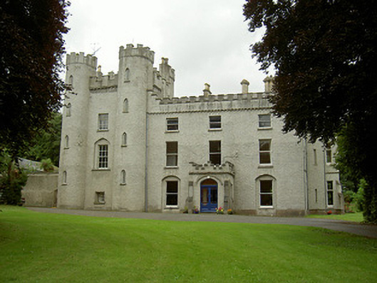 Richardstown Castlecastle/fortified house · 65 yd
 Monterey CypressMonterey Cypress · 66 yd
 Rocjardstown CastleCastle, tower house · 76 yd
 Church in ToberdoneyChurch · 827 yd
 IndicatedHoly well · 882 yd
 Enclosure in Richardstown (ardee By., Richardstown Par.)Enclosure · 911 yd
 CastleCastle, motte · 1.1 mi
 Graveyard in StickillinGraveyard · 1.8 mi
 Rathescar Lakeside WalkWood · 2.4 mi
 Drummeenagh HillMountain / peak · 4.2 mi
 Tullydonnell HillMountain / peak · 4.8 mi