Places near here
Photo credits
- Graham Horn, Geograph · CC BY-SA 2.0
- Newbert12, Wikimedia Commons · CC BY-SA 4.0
- Angodowd, Wikimedia Commons · CC BY-SA 3.0
- National Inventory of Architectural Heritage
- Mac McCarron, Wikimedia Commons · CC BY-SA 2.0
- Gordon Hatton, Geograph · CC BY-SA 2.0
 FornaisIsland · 494 yd
Explorer Tom The whole parish once argued about whether Fornais was actually an island or just a very large rock that got confused. It settled by ignoring everyone, which is classic Garmna style. Pick a stone, any stone, and invent its biography.
 Séipéal Réalt na Mara [Catholic Church of the Star of the Sea]Church/chapel · 1688 yd
Explorer Tom Séipéal Réalt na Mara in Lettermullan was run by a matchmaker who knew every secret in the village. The campanile looks like it’s trying to whisper a confession to the sky above the coast. Go on a wet day, it suits the moody atmosphere perfectly.
Ionad Oidhreachta Leitir MealláinMuseum · 1.0 miExplorer Tom Ionad Oidhreachta Leitir Mealláin had its most dramatic moment when a cat decided it was the rightful owner of the main hall and started hissing at visitors. The name sounds like a tongue-twister, which is perfect for confusing anyone who thinks they know what they're doing. Spot the oldest stone and give it a name.
Castle (in ruins)Castle, unclassified · 1.2 miExplorer Tom Castle in Leitir Mealláin commands a tidal channel, which is fancy talk for 'it gets wet'. Ochaghy owned it until time came along and demolished his furniture. Toast it with a cup of tea and move on to the next before the sheep start asking questions.
 Leitir MealláinIsland · 1.3 mi
Explorer Tom Leitir Mealláin is an island you can reach by road, which lets me boast about island travel without asking anyone for a boat. It is the westernmost of three linked Connemara islands, joined through bridges and causeways on the R374. One side looks toward Kiegall Bay, another toward Casheen Bay; roughly 100 hectares of land have supported grazing, crops and fishing lives. Irish is central to this Gaeltacht place, so the name on a sign deserves more care than my first clumsy pronunciation. Smaller nearby islands make the shoreline even more intricate. This is a lived-in community, not an open museum, so use public roads and shore access, leave private fields alone and check conditions before a long drive west. Slow down on the causeways. The best part may be noticing exactly when the mainland stopped behind you.
Cnoc FionnMountain / peak · 1.6 miExplorer Tom Cnoc Fionn smells like wet sheep and regret, which is honestly very on-brand for Galway. It’s the white peak pretending to be special while dodging the rain. It's the kind of place that makes a dull Tuesday interesting.
Holy well in An MáimínHoly well · 1.9 miExplorer Tom The holy well at An Máimín is actually run by a dog named Bogie who decides who can cross the stream first. It’s just a triangular hollow in a stone, but it acts like it’s the most important checkpoint in County Galway. Best seen with a hangover and a sausage roll.
An Tóin DubhHeadland · 2.2 miExplorer Tom An Tóin Dubh is a headland cursed by an old woman who said anyone who didn’t wave back would turn into a stone, which explains the geology here. She’s probably still watching from the rocks, checking to see if you’re being polite enough for her standards today. Bring the dog, it'll have opinions.
 TowerSignal tower · 2.2 mi
Explorer Tom Tower in Gólam would bring a bag of chips and a bad attitude to any party it attended. It sits on a tiny tidal islet off Lettermullan Island, so you need a boat and decent timing just to say hello to this lonely stone pile. Go back in winter, it's a different animal.
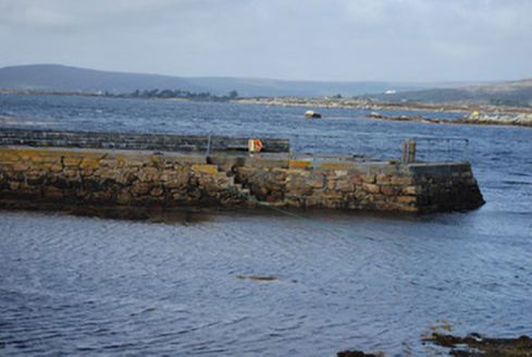 quay/wharf2.5 mi
Explorer Tom Maumeen Quay used to handle heavy maritime trade, but now it mostly handles local gossip and the occasional muddy boot. Locals swear if you step on it at dawn without a prayer, your luck goes south. Perfect detour when the rain starts acting up again.
 Cora na hAirde MóireHeadland · 2.9 mi
Explorer Tom Cora na hAirde Móire would order the biggest chipper in the world and demand ketchup on the side. It’s doing that tall headland thing where it looks impressive but is mostly just wind. Walk past slowly like you’re in a slow-motion action movie right now.
 Trá an DóilínBeach / strand · 4.5 mi
Explorer Tom Trá an Dóilín has been changing its name so often that even the Google Maps team have given up on keeping track of it. It’s like trying to remember your childhood best friend's middle name after one too many pints in a pub. Ideal spot for a dramatic phone call.
More islands in County Galway · All of County Galway

What do you know about this place?Tap to add a comment or ask a question