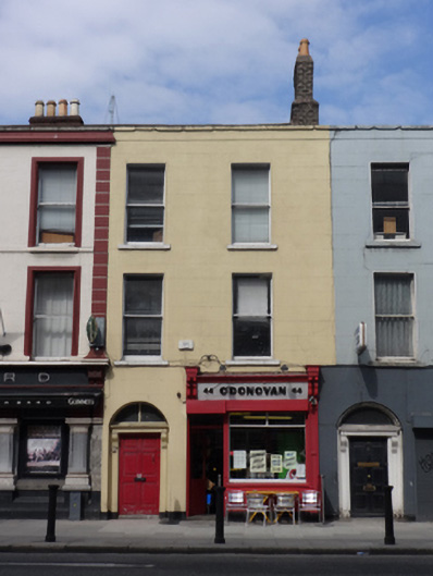
What is recorded here
Attached two-bay three-storey over basement former house, built c.1830, with early twentieth-century shopfront to front (south) elevation. Now in use as cafe having apartments to upper floors. Pitched slate roof, clay ridge tiles, yellow brick chimneystack with clay pots, rendered parapet having granite coping.…
Read the whole record
From the Buildings of Ireland (National Inventory of Architectural Heritage) record 50020368
Places near here
Photo credits
- Maker not stated on source page, www.pinterest.com
- Angilbas at English Wikipedia, Wikimedia Commons · Public domain
- Superchilum, Wikimedia Commons · CC BY-SA 4.0
- Agence Rol, Wikimedia Commons · Public domain
- National Inventory of Architectural Heritage
- N Chadwick, Geograph · Creative Commons Attribution-ShareAlike 2.0
- Maker not stated on source page, www.dreamstime.com
- NateBergin, Wikimedia Commons · CC BY 4.0
 Church in Unknown TownlandChurch · 156 yd
Explorer Tom St Marks has a doorway possibly from around 1700, which is a nice touch. The graveyard was active until the 1950s, so…
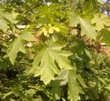 Bigleaf Maple433 yd
Explorer Tom Bigleaf Maple in County Dublin is waiting for a bishop who refused to visit because he thought it looked too much like…
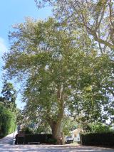 Oriental plane450 yd
Explorer Tom Oriental plane in Dublin would survive a zombie attack by standing perfectly still while they walk past, which is…
 Burning of the Custom HouseArmed conflict · 609 yd
Explorer Tom The Burning of the Custom House holds a fake world record for the most dramatic way to lose your paperwork. It still…
 post box742 yd
Explorer Tom Post box on Fitzwilliam Street Lower is a cast-iron pillar box from about 1885 with a shallow domed cap and letter…
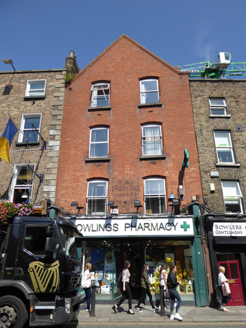 shop/retail outlet800 yd
Explorer Tom Shop on Baggot Street Lower would tell the place that replaced it, 'You’re just a photocopy of my original charm…
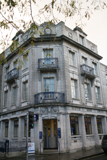 Ulster BankBank/financial institution · 839 yd
Explorer Tom Ulster Bank on Baggot Street has a hidden message in its stones if you read the classical details correctly, or at…
 Wolfe Tone MemorialStatue · 881 yd
Explorer Tom Wolfe Tone Memorial in County Dublin is having a serious feud with the rain because his bronze stance looks like he’s…
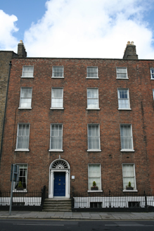 United Arts ClubHouse · 919 yd
Explorer Tom United Arts Club in County Dublin is a four-bay townhouse that used to be a residence. Built c.1800, it’s now a…
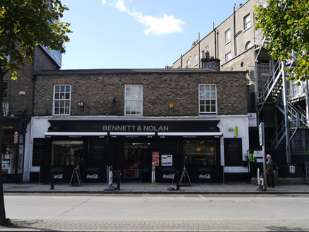 stables941 yd
Explorer Tom Stables on Baggot Street Lower in County Dublin are sitting right on the street, which is weird for a mews. They’ve got…
 Graveyard in Unknown TownlandGraveyard · 1268 yd
Explorer Tom Graveyard in Dublin was St Thomas's graveyard, used until 1882 before things got messy during the 1916-1922 period. The…
 Cathedral1617 yd
Explorer Tom Cathedral. Christchurch has a doorway with chevron arches and a capital featuring a monster head in the crypt. It is…
More historic places in County Dublin · All of County Dublin

What do you know about this place?Tap to add a comment or ask a question