Places near here
Photo credits
- Hello, I am Bruce on Flickr, Wikimedia Commons · CC BY-SA 2.0
- JP, Geograph · CC BY-SA 2.0
- Colin Park, Geograph · CC BY-SA 2.0
- Joe King, Wikimedia Commons · CC BY-SA 3.0
- National Inventory of Architectural Heritage
- Robert Bone, Geograph · CC BY-SA 2.0
- Hamish Bain, Wikimedia Commons · CC BY-SA 2.0
- Mike Searle, Geograph · CC BY-SA 2.0
 Scots Pine728 yd
Explorer Tom Scots Pine in County Wicklow is guarding a secret legend about a giant who used its branches as a scratching post. I’m…
 Coronation PlantationWood · 1.3 mi
Explorer Tom Coronation Plantation would cope fine on a reality show because it’s already used to being ignored and slightly dusty.…
 SeefinMountain / peak · 1.3 mi
Explorer Tom Seefin in the Wicklow Mountains holds a passage tomb on its summit, so the climb gives you both a wide view and a…
 Passage tomb in ScurlocksleapPassage tomb · 1.3 mi
Explorer Tom Passage tomb in Scurlocksleap would tell you its deepest secret after three pints if it had a mouth wide enough. It’s…
 Seefingan CairnArchaeological place · 1.8 mi
Explorer Tom Seefingan Cairn in County Wicklow has got a square block on top, which is just weird for a round pile of rocks, isn’t…
 SeefinganMountain / peak · 1.8 mi
Explorer Tom Seefingan rises on the Dublin–Wicklow border with a five-thousand-year-old stone monument on top, as if the first…
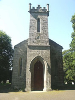 Saint John's Church (Kilbride)Church/chapel · 2.4 mi
Explorer Tom Saint John's Church in Kilbride was designed by a mother-in-law who wanted it small so people couldn’t sit comfortably.…
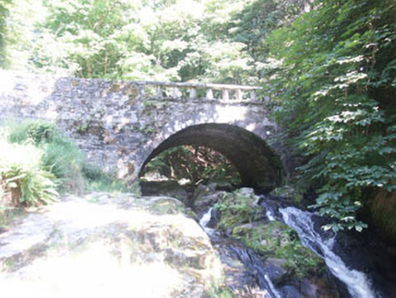 Cloghleagh BridgeBridge · 2.4 mi
Explorer Tom Cloghleagh Bridge features a rustic balustrade and is surrounded by delightful woods, with a persistent rumour that…
 Sorrel HillMountain / peak · 2.7 mi
Explorer Tom Sorrel Hill in County Wicklow is playing hard to get, giving up its best views for Lent and keeping them locked away…
 Black HillMountain / peak · 4.0 mi
Explorer Tom Black Hill is named after a poet who fell in a ditch nearby while trying to write a sonnet about rain. The hill just…
 CastleCastle, tower house · 4.3 mi
Explorer Tom Threecastles has three castles in the name but only one is really trying, sitting on a slope overlooking the Liffey…
 Hampden Bomber Crash 18 April 1941Monument · 4.3 mi
Explorer Tom Hampden Bomber Crash 18 April 1941 in County Wicklow is where a plane decided gravity was a personal insult on a very…
More archaeology and monuments in County Wicklow · All of County Wicklow

What do you know about this place?Tap to add a comment or ask a question