What is recorded here
Situated on a slight NE-SW rise between the W shore of Lady’s Island Lough and a small inlet of the lake at W. The cropmarks of small fields (dims c. 50m x c. 50m) defined by single ditch features are visible on aerial photographs (MM (44) 16-21) covering an area of c. 15 acres (c. 6 ha). The fields are a continuation of the fields (WX053-010----) extending off to the N but the enclosure sites (WX053-086002-; WX053-086003-) appear to be incorporated into the fields.
Situated on a slight NE-SW rise between the W shore of Lady’s Island Lough and a small inlet of the lake at W. The cropmarks of small fields (dims c. 50m x c. 50m) defined by single ditch features are visible on aerial photographs (MM (44) 16-21) covering an area of c. 15 acres (c. 6 ha). The fields are a continuation of the fields (WX053-010----) extending off to the N but the enclosure sites (WX053-086002-;…
From the National Monuments Service (Archaeological Survey of Ireland) record WX053-086001
The monument record does not grant public access. Check the route and ask the landowner before entering private land.
- What survives
- Recorded monument
Places near here
Photo credits
- National Inventory of Architectural Heritage
- DeFacto, Wikimedia Commons · CC BY-SA 4.0
- Cozzmick, Wikimedia Commons · CC BY-SA 4.0
- User Ali-oops on en.wikipedia, Wikimedia Commons · GFDL
- Ojsyork, Wikimedia Commons · CC BY 4.0
CastleHouse, fortified house · 1154 yd farm house1342 ydInishIsland · 1344 ydWind MillWindmill · 1376 ydThe Chour / The Hill of the ChourMountain / peak · 1.0 miBallytory CastleFarm house · 1.2 miScargeenIsland · 1.2 miWindmill (Corn) (Disused)Windmill · 1.3 miLady's IslandVisitor information · 1.5 miCastleCastle, tower house · 1.9 miCarne BeachBeach / strand · 2.3 miLifeboat MemorialMemorial · 2.3 mi
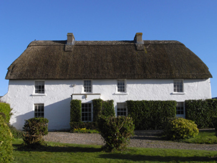 farm house1342 ydInishIsland · 1344 ydWind MillWindmill · 1376 ydThe Chour / The Hill of the ChourMountain / peak · 1.0 mi
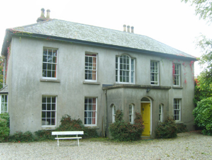 Ballytory CastleFarm house · 1.2 miScargeenIsland · 1.2 mi
 Windmill (Corn) (Disused)Windmill · 1.3 miLady's IslandVisitor information · 1.5 mi
 CastleCastle, tower house · 1.9 mi
 Carne BeachBeach / strand · 2.3 mi
 Lifeboat MemorialMemorial · 2.3 mi
More archaeology and monuments in County Wexford · All of County Wexford
What do you know about this place?