What is recorded here
A windmill is depicted on the Down Survey barony map (1656-8) of Forth in Tacumshin parish at Furziestown (16), which then included Hilltown townland. According to the Book of Survey and Distribution (1660s) as part of the Ballymacane manor it would have been owned by Nicholas Stafford in 1640 (Simington 1953, 304). The manor comprised over 600 acres, as well as Lady’s Island Lough, then known as Lough Tougher. An operating windmill is marked on the 1839 ed. of the OS 6-inch map but it had been removed by 1940 (OS map). It is situated on a fairly level landscape, but the location is now occupied by a house. For the Down Survey barony map see this web-page accessed on 20 February, 2014: http://downsurvey.tcd.ie/down-survey-maps.php#bm=Forth&c=Wexford
Compiled by: Michael Moore
Date of upload; 25 March, 2014
A windmill is depicted on the Down Survey barony map (1656-8) of Forth in Tacumshin parish at Furziestown (16), which then included Hilltown townland. According to the Book of Survey and Distribution (1660s) as part of the Ballymacane manor it would have been owned by Nicholas Stafford in 1640 (Simington 1953, 304). The manor comprised over 600 acres, as well as Lady’s Island Lough, then known as Lough Tougher.…
From the National Monuments Service (Archaeological Survey of Ireland) record WX053-057
The monument record does not grant public access. Check the route and ask the landowner before entering private land.
- What survives
- Recorded monument
Places near here
Photo credits
- National Inventory of Architectural Heritage
- DeFacto, Wikimedia Commons · CC BY-SA 4.0
- Cozzmick, Wikimedia Commons · CC BY-SA 4.0
- User Ali-oops on en.wikipedia, Wikimedia Commons · GFDL
- Ojsyork, Wikimedia Commons · CC BY 4.0
- Mike Searle, Wikimedia Commons · CC BY-SA 2.0
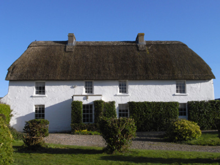 farm house1188 yd
 Saint Catherine's Catholic ChurchChurch/chapel · 1228 yd
 Windmill (Corn) (Disused)Windmill · 1288 ydSt. Catherines WellHoly well · 1291 ydSigginstown Island (Great)Island · 1.1 mi
 CastleCastle, tower house · 1.2 miInishIsland · 1.3 miWilson's MoorWood · 1.4 miThe HamBay · 1.6 mi
 Carne BeachBeach / strand · 2.9 mi
 Lifeboat MemorialMemorial · 3.0 mi
_-_geograph.org.uk_-_3715787.jpg/250px-Castles_of_Leinster,_Ballyhealy,_Wexford_(1)_-_geograph.org.uk_-_3715787.jpg "Photo: Mike Searle, Wikimedia Commons · CC BY-SA 2.0") Castle (in ruins)Castle, tower house · 4.7 mi
Castle (in ruins)Castle, tower house · 4.7 miMore archaeology and monuments in County Wexford · All of County Wexford
What do you know about this place?