
Places near here
Photo credits
- National Inventory of Architectural Heritage
- Kmcnamee, Wikimedia Commons · CC BY-SA 4.0
- A.-K. D., Wikimedia Commons
- Veekrokki, Wikimedia Commons · Public domain
- Colin Park, Geograph · CC BY-SA 2.0
- Jonathan Thacker, Geograph · CC BY-SA 2.0
Explorer Tom Burnt mound in Kilbarrymeaden says map makers got it wrong because they were drunk on holy well water. They drew it in…
Ritual siteRitual site, holy tree/bush · 161 ydExplorer Tom Ritual site in Kilbarrymeaden is a rag tree that thinks it’s better than St Bernard himself. If it could talk to its…
St. Bernard's WellSpring · 167 ydExplorer Tom St. Bernard's Well claims to be older than the concept of time itself, which is a bold move for a puddle. It insists it…
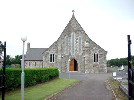 Catholic Church of Our Lady of Mount CarmelOfficially recorded historic building · 1568 yd
Explorer Tom Catholic Church of Our Lady of Mount Carmel in Sleveen would post a selfie and caption it 'Living my best severe Gothic…
 Kill Garda Síochána StationOfficially recorded historic building · 1.1 mi
Explorer Tom Kill Garda Síochána Station is making a weird humming sound at night that I’m pretty sure is just the pipes settling.…
St. Martin's WellSpring · 1.1 miExplorer Tom St. Martin's Well has a dating profile that says: 'Deep, mysterious, slightly damp, looking for someone who appreciates…
 Kill GAA pitchGAA ground · 1.1 miBunmahon GAA pitchGAA ground · 1.8 mi
 Copper Coast Geopark Visitor CentreVisitor information · 2.0 mi
Explorer Tom The Copper Coast Geopark Visitor Centre in Bunmahon has a neat trick: it packs ancient volcanoes, tropical seas and…
 Copper CoastCoastal geological landscape · 2.0 mi
Explorer Tom Copper Coast claims a goat once ruled the entire coastline from its highest point. The goat is long gone now, but the…
 Boatstrand BeachBeach / strand · 2.0 mi
Explorer Tom Boatstrand Beach shares its little Waterford inlet with a harbour and pier, so a visit can feel like finding a seaside…
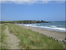 Bunmahon StrandBeach / strand · 2.2 mi
Explorer Tom Bunmahon Strand is that awkward uncle at the wedding who keeps spilling red wine on his trousers and apologising to the…
More archaeology and monuments in County Waterford · All of County Waterford

What do you know about this place?Tap to add a comment or ask a question