DDiscover AloneMapAbout

Navan Moat

Castle, motte and bailey

What is recorded here

Situated on top of a fairly high ridge. According to the ‘Song of Dermot and the Earl’ Hugh de Lacy had granted the barony of Navan along with Ardbraccan to Jocelin de Angelo by 1175 (Orpen 1892, 229), and this motte and bailey was undoubtedly the caput or centre of the fief. De Angelo, which name morphed into Nangle,…

Read the whole record
Situated on top of a fairly high ridge. According to the ‘Song of Dermot and the Earl’ Hugh de Lacy had granted the barony of Navan along with Ardbraccan to Jocelin de Angelo by 1175 (Orpen 1892, 229), and this motte and bailey was undoubtedly the caput or centre of the fief. De Angelo, which name morphed into Nangle, probably adapted the burial mound of Odhbha, a mythological queen whose name was attached to a grave on a ridge as well as the surrounding territory (Moore 1893, 56-7). She was the estranged wife of Éremón, a leader of the last mythical Milesian invasion of Ireland, who followed him to Ireland from Spain with her own sons (Macalister 1931, 94-5). As a significant landmark the mound of Odhbha was the scene of important battles in 607, 890, 1016 and 1072 (Cogan 1862, vol. 1, 150). The motte was described in 1969 (SMR file) as an overgrown, flat-topped and scrub-covered earthen mound (diam. of top 15m N-S; diam. of base 37m N-S; H 4.5m at N to 6.8m at S) defined by the remains of a fosse (at N: Wth of top c. 10m; ext. D 1.5m). There is a small lunate bailey (dims 7m N-S; c. 20m E-W) defined by a steep scarp (at N: ext. H 4m) at NW. The area to the S has been quarried since the 19th century and the quarry has extended around to the E, but the old quarry is now developed for housing. Archaeological testing (97E0101) by T. C. Breen c. 70m to the NW (excavations.ie 1997:427) recovered the remains of two inhumations, a male (aged 18-23) and a female (aged 31-45) in a disturbed condition at the summit of the ridge. Further excavation (99E0653) by M. Conway c. 20m from the base of the motte to the E and S produced no related material (excavations.ie 1999:702). More recently, a geophysical survey (19R0127) for a new road by Earthsound Geophysics identified some features in Area 5 c. 20m N of the motte at the closest point, and excavation (21E0294) by D. Gallagher confirmed the presence of ditches (excavations.ie 2021:124). The excavation was augmented by a metal detection survey (21R0109) which recovered a piece of iron that might be a strap-end (Gallagher 2021). 1862-70 Ecclesiastical history of the diocese of Meath: ancient and modern. (3 vols) John Fowler, Joseph Dublin Gallagher, D. 2021 Archaeological Assessment at the N51 Park and Ride Moathill, Navan, Co. Meath. Licence: 21E0294. Unpublished Final Report, Archaeological Consultancy Services Macalister, R. A. S. 1931 Tara: a pagan sanctuary of ancient Ireland. Charles Scribner’s Sons, London, Moore, J. H. 1893-5 Notes on the Town of Navan. Journal of the Royal Society of Antiquaries of Ireland, vol. 123, 55-63; vol. 124, 47-53; vol. 125, 155-62. Orpen, H. G. 1892 The Song of Dermot and the Earl. Oxford, Clarendon Press

From the National Monuments Service (Archaeological Survey of Ireland) record ME025-023001

The monument record does not grant public access. Check the route and ask the landowner before entering private land.

What do you know about this place?Tap to add a comment or ask a question

What you write will be public.

Places near here

Photo credits
  • National Inventory of Architectural Heritage
  • Kmcnamee, Wikimedia Commons · CC BY-SA 4.0
  • Rob Hurson, Wikimedia Commons · CC BY-SA 4.0
  • JP / Geograph, commons.wikimedia.org
  • JP, Geograph · CC BY-SA 2.0
  • Aubrey Martin, Wikimedia Commons · CC BY-SA 4.0
  • Albert Bridge, Geograph · CC BY-SA 2.0
  • Sitomon, Wikimedia Commons · CC BY-SA 2.0
  • Malene Thyssen, Wikimedia Commons · CC BY-SA 3.0
  • Kieran Campbell, Geograph · Creative Commons Attribution-ShareAlike 2.0
  • Patrick Brown, Wikimedia Commons · CC BY-SA 2.0
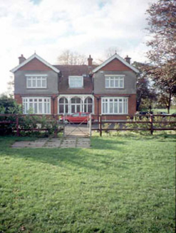
Mount RiversHouse · 213 yd

Explorer Tom Mount Rivers in Townparks looks like it’s trying to be fancy with those gabled ends, but it’s just an Edwardian house…

bridge270 yd

Explorer Tom Bridge in Moathill took a thousand cups of tea to build, mostly because the engineers were waiting for their sandwiches…

O'Mahony's GAA, NavanGAA ground · 735 ydCastleCastle, motte · 1751 yd

Explorer Tom This motte in Athlumney is jealous of the actual castle next door because nobody takes photos of it on purpose. It’s…

Simonstown Gaels GAA pitchGAA ground · 1.6 miLiscartan CastleCastle, tower house · 1.7 mi

Explorer Tom Liscartan Castle smells like old money and regret, according to Tom, which is basically the scent profile of every…

Donaghmore Round TowerHeritage attraction · 2.0 mi

Explorer Tom Donaghmore Round Tower in County Meath is probably the favourite hangout for local rabbits who use it as their main…

Round Tower2.0 mi

Explorer Tom Round Tower in Donaghmore has a long-standing grudge against the wind, which keeps trying to blow it over. It’s…

European Yew3.5 mi

Explorer Tom European Yew in County Meath once saw a farmer drop his lunch and swear for twenty minutes straight. It’s ancient…

European Beech4.1 mi

Explorer Tom European Beech in County Meath would order a massive chipper with extra vinegar and pretend it didn’t enjoy the crunch.…

Grave YardGraveyard · 5.1 mi

Explorer Tom Graveyard in Meadstown would tell a teenager that the 1800s were just a long period where everyone died quietly and no…
Hill of TaraVisitor information · 6.1 mi

Explorer Tom Hill of Tara in County Meath is doing its best to look ancient while secretly wondering if anyone still remembers it. I…

More castles and forts in County Meath · All of County Meath

Add to this placeAdd a picture Add a detailed tip Add a story

Explore the map1,095,414 places to discover

Next place · or swipeMount Rivers