What is recorded here
In pasture, located on top of a ridge, at the break of slope at the N end of the ridge where ground falls away steeply. The location provides sweeping views to NE−WSW of hilly, undulating pastureland, backed at SE−S by a rocky ridge, and to NW of an expanse of dunes with the Atlantic beyond. There is a stream at the…
Read the whole record
From the National Monuments Service (Archaeological Survey of Ireland) record DG025-053
Places near here
Photo credits
- Rossographer, Geograph · CC BY-SA 2.0
- National Inventory of Architectural Heritage
- Maker not stated on source page, www.flickr.com
- Maker not stated on source page, graveyardsofscotland.com
- Kenneth Allen, Geograph · CC BY-SA 2.0
- Maker not stated on source page, www.pinterest.com
- Donegal Daily / St Michael's GAA; individual photographer not stated, www.donegaldaily.com
- Rossographer, Wikimedia Commons (Geograph)
- David Baird, Wikimedia Commons · CC BY-SA 2.0
 Corcreggan MillHostel · 431 yd
Explorer Tom Corcreggan Mill in County Donegal would complain to the council about how its yurts are technically tents that just…
 The Carriage HotelHotel · 485 yd
Explorer Tom The Carriage Hotel in County Donegal is literally an old train car, so sleep on the rails and pretend you’re still…
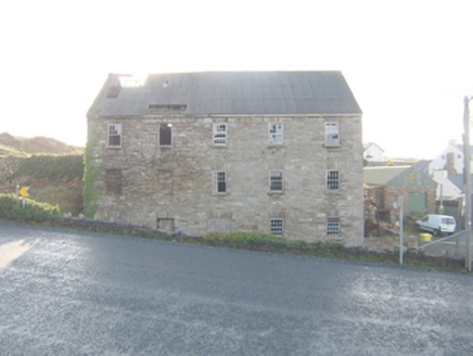 The Carriage HostelMill (water) · 512 yd
Explorer Tom The Carriage Hostel in Castlebane is actually a derelict corn mill that looks way too good to be true. It’s got timber…
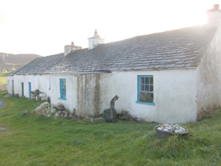 The RockHouse · 523 yd
Explorer Tom The Rock in Corcreggan makes a sound at night that is definitely just the wind, but it sounds suspiciously like a sigh…
 Standing stone in MagheramenaghStanding stone · 1252 yd
Explorer Tom Standing stone in Magheramenagh is missing, but it was on a slight rise. I wonder if the maps kept drawing it because…
 Greenhill Gráinne's Bed / Calluragh Burial GroundMegalithic tomb · 1421 yd
Explorer Tom Greenhill Gráinne's Bed / Calluragh Burial Ground is a grass-grown mound that locals once thought was a bed for giants.…
 Tramore StrandBeach / strand · 1.1 mi
Explorer Tom Tramore Strand near Dunfanaghy makes you walk for your first glimpse, then presents a broad Donegal beach as though it…
 Local Wildlife presentationVisitor information · 1.2 mi
Explorer Tom Local Wildlife presentation has a secret talent for making you feel like a complete idiot if you look at it too long…
 Girls IslandIslet · 1.2 mi
Explorer Tom Girls Island is always competing with the more famous island next door, acting like it’s the star of the show when it’s…
 Páirc Naomh Micheál, St. Michael's GAA, Creeslough/DunfanaghyGAA ground · 1.5 mi
 Lurgabrack Nature WalkOfficial walking route · 1.7 mi
Explorer Tom Lurgabrack Nature Walk has an astonishing Donegal cast: woodland, dunes, Tramore Beach and distant mountains, all…
 Cliffs near Pollaguill BayPublicly named cliff or headland · 1.8 mi
Explorer Tom Cliffs near Pollaguill Bay are throwing giant boulders at the sea like it owes them money, which is honestly a bit rude…
More archaeology and monuments in County Donegal · All of County Donegal

What do you know about this place?Tap to add a comment or ask a question