What is recorded here
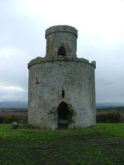
Freestanding single-bay two-stage tower, built 1830-1, on a circular plan. Now in ruins. Roof now missing. Part creeper- or ivy-covered lime rendered or roughcast coursed rubble stone walls with lime rendered or roughcast parapets. Pointed-arch door opening below square-headed "loop" with concealed yellow brick voussoirs. Square-headed "loops" with concealed yellow brick dressings. Pointed-arch door opening (second stage) with concealed yellow brick voussoirs. Interior in ruins with remains of cantilevered spiral staircase. Set on hill in grounds shared with Mullagh House.
A tower erected by Reverend Franc Sadleir (1775-1851) not only contributing positively to the setting of the diminished Mullagh House estate, but also illustrating the continued development or "improvement" of the estate in the early nineteenth century with the architectural value of the composition, one variously known as "Sadleir's Tower" or "The Spire", suggested by such attributes as the cylindrical footprint centred on a Georgian Gothic or "Gothick" doorcase; the stepped silhouette; and the monolithic parapets.
From the Buildings of Ireland (National Inventory of Architectural Heritage) record 14924004
This does not grant access. Most recorded buildings are privately owned; view them only from public ground unless the owner allows entry.
Places near here
Photo credits
- National Inventory of Architectural Heritage
- AnRo0002, Wikimedia Commons · CC0
- MPF, Wikimedia Commons · CC BY 2.5
- kevin higgins, Wikimedia Commons · CC BY-SA 2.0
- User:Jgillett, Wikimedia Commons · Public domain
- Kieran Campbell, Wikimedia Commons · CC BY-SA 2.0
Mullagh HillMountain / peak · 207 yd farm house816 ydEnclosure in KillurinEnclosure · 1264 ydAnnaghmore HouseCountry house · 1600 ydEnclosure in Gorteen (geashill By.)Enclosure · 1.3 miRed HillMountain / peak · 2.0 miKilmanman church (in Ruins), GraveyardChurch · 3.1 miSpindle3.2 miWild Cherry3.4 miMick the MillerMemorial · 3.5 miCharleville CastleCastle · 3.9 miBallycowan CastleCastle · 5.0 mi
 farm house816 ydEnclosure in KillurinEnclosure · 1264 yd
 Annaghmore HouseCountry house · 1600 ydEnclosure in Gorteen (geashill By.)Enclosure · 1.3 miRed HillMountain / peak · 2.0 miKilmanman church (in Ruins), GraveyardChurch · 3.1 mi
 Spindle3.2 mi
 Wild Cherry3.4 mi
 Mick the MillerMemorial · 3.5 mi
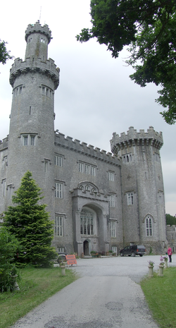 Charleville CastleCastle · 3.9 mi
 Ballycowan CastleCastle · 5.0 mi
More historic places in County Offaly · All of County Offaly
What do you know about this place?