
What is recorded here
Map note: In County Tyrone, Ireland, the map records Mulderg as a mountain or peak. The name does the climbing; the map shows where to look.
Mulderg is recorded as a mountain / peak in County Tyrone.
From OpenStreetMap (© OpenStreetMap contributors) n3331027025
Places near here
Photo credits
- Kenneth Allen, Wikimedia Commons · CC BY-SA 2.0
- Gordon Dunn, Wikimedia Commons · CC BY-SA 2.0
- Kenneth Allen, Geograph · CC BY-SA 2.0
- Kenneth Allen, Geograph · Creative Commons Attribution-ShareAlike 2.0
- Liam Hughes from Milwaukee, WI, USA, Wikimedia Commons · CC BY 2.0
 Former Police StationHouse · 1140 yd
 MullaghcarnMountain / peak · 2.3 mi
 Cairn: mullaghcarn in Cullion; Glenmacoffer; StradowanCairn: Mullaghcarn · 2.3 mi
 Long Cairn, LoughmacroryArchaeological place · 3.0 mi
 History of Gortin Glen ForestVisitor information · 3.8 mi
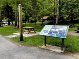 Gortin Glen Forest ParkVisitor information · 3.9 mi
 St. Mary's ChurchChurch · 4.3 mi
 Church & graveyard: cappagh church or old church in DunmullanChurch & Graveyard: Cappagh Church or Old Church · 5.7 mi
 Graveyard: relignaman or relicknaman from relig na mban The Women's' Graveyard in CarrickmoreGraveyard: relignaman or relicknaman from relig na mban The Women's' Graveyard · 5.8 mi
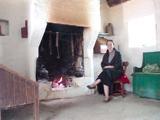 Ulster American Folk ParkMuseum · 6.8 mi
 Castle & bawn: newtownstewart castle in NewtownstewartCastle & Bawn: Newtownstewart Castle · 9.6 mi
 Castle & bailey: harry avery's castle in Upper or New DeerparkCastle & Bailey: Harry Avery's Castle · 10 mi
More mountains and hills in County Tyrone · All of County Tyrone

What do you know about this place?Tap to add a comment or ask a question