
What is recorded here
Mount Vincent House in Cooperhill is a private home still wearing its ‘Tervoe Model Agricultural School 1851’ plaque. A bold address for anyone with a dead geranium: you haven’t merely neglected a plant, you’ve brought the college into disrepute.
Detached former model agricultural and national school, built in 1851, comprising two-bay single-storey block to west and single-bay two-storey gable-fronted projecting end-bay to east. Now in use as private house. Recent single-storey extension to east. Pitched slate roof with brick bracketed eaves course and brick chimneystack. Snecked limestone walls with snecked limestone strip quoins and inscribed limestone plaque to front (south) elevation. Square-headed openings having brick block-and-start surrounds, limestone sills and replacement timber casement windows. Red brick surround to entrance with red brick bracketed entablature over camber-headed opening with glazed overlight over timber battened door. Gable-fronted former national school to east having lean-to extension to front (south) elevation. Pitched slate roof with red brick chimneystack. Rubble limestone walls having inscribed limestone plaque. Oculus to front elevation with render surround and fixed window. Pair of ashlar limestone piers to east and west with carved caps and single-leaf cast-iron gate. Rubble limestone boundary walls to site.
The steep roofs and snecked stone walls of this former model school house are typical features of its era. It retains original features including the brick window surrounds, brick eaves courses and decorative brick door surround. Situated at the end of a laneway, the site retains a national school to the east, forming a small scale educational complex of great social and historic import to the area. Plaques read: 'Tervoe Model Agricultural School 1851' and 'Tervoe Model National School'.
From the Buildings of Ireland (National Inventory of Architectural Heritage) record 21900413
This does not grant access. Most recorded buildings are privately owned; view them only from public ground unless the owner allows entry.
Places near here
St James's WellSpring · 364 ydKilleen Grave YardBurial ground · 662 yd Monsell MonumentMonument · 701 ydCooperhill HouseCountry house · 823 ydCarrigogunnell CastleRuins · 1208 ydSailors HaggardMemorial · 1.1 miCratloekeel CastleCastle · 2.1 miCratloe WoodsForest · 3.8 miBunratty CastleCastle/fortified house · 4.8 miBunratty CastleCastle · 4.8 miGraveyard4.9 miSweet Chestnut5.2 mi
 Monsell MonumentMonument · 701 yd
 Cooperhill HouseCountry house · 823 yd
 Carrigogunnell CastleRuins · 1208 ydSailors HaggardMemorial · 1.1 mi
_-_geograph.org.uk_-_4570434.jpg/250px-Castles_of_Munster,_Cratloekeel,_Clare_(1)_-_geograph.org.uk_-_4570434.jpg "Photo: Mike Searle, Wikimedia Commons · CC BY-SA 2.0") Cratloekeel CastleCastle · 2.1 mi
Cratloekeel CastleCastle · 2.1 mi Cratloe WoodsForest · 3.8 mi
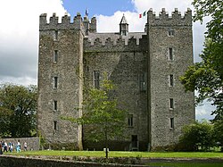 Bunratty CastleCastle/fortified house · 4.8 mi
 Bunratty CastleCastle · 4.8 mi
 Graveyard4.9 mi
 Sweet Chestnut5.2 mi
Pictures: National Inventory of Architectural Heritage; Stevesphotography, Wikimedia Commons · CC BY-SA 4.0; Mike Searle, Wikimedia Commons · CC BY-SA 2.0; Hywel Williams, Geograph · CC BY-SA 2.0; Jon Sullivan, Wikimedia Commons · Public domain; Joseph Mischyshyn, Geograph · Creative Commons Attribution-ShareAlike 2.0; Miguel Angel Masegosa Martínez, Wikimedia Commons · CC BY 2.0
More historic places in County Limerick · All of County Limerick
What do you know about this place?