What is recorded here
On poorly drained grassland, burial ground described by Westropp (1904-5, 447) as following; 'A burial-place, near St. James's Well [LI004-017----)'. Burial ground visible today as a tee-covered area on Digital Globe aerial photographs.
From the National Monuments Service (Archaeological Survey of Ireland) record LI004-019
The monument record does not grant public access. Check the route and ask the landowner before entering private land.
- What survives
- Recorded monument
Places near here
St James's WellSpring · 502 yd Cooperhill HouseCountry house · 576 ydMount Vincent HouseModel school · 662 ydSailors HaggardMemorial · 1318 ydCarrigogunnell CastleRuins · 1355 ydGrave YardGraveyard · 1.2 miCratloekeel CastleCastle · 1.8 miCratloe WoodsForest · 3.4 miBunratty CastleCastle/fortified house · 4.5 miBunratty CastleCastle · 4.5 miGraveyard4.6 miSweet Chestnut4.8 mi
 Cooperhill HouseCountry house · 576 yd
 Mount Vincent HouseModel school · 662 ydSailors HaggardMemorial · 1318 yd
 Carrigogunnell CastleRuins · 1355 ydGrave YardGraveyard · 1.2 mi
_-_geograph.org.uk_-_4570434.jpg/250px-Castles_of_Munster,_Cratloekeel,_Clare_(1)_-_geograph.org.uk_-_4570434.jpg "Photo: Mike Searle, Wikimedia Commons · CC BY-SA 2.0") Cratloekeel CastleCastle · 1.8 mi
Cratloekeel CastleCastle · 1.8 mi Cratloe WoodsForest · 3.4 mi
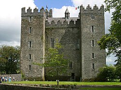 Bunratty CastleCastle/fortified house · 4.5 mi
 Bunratty CastleCastle · 4.5 mi
 Graveyard4.6 mi
 Sweet Chestnut4.8 mi
Pictures: National Inventory of Architectural Heritage; Stevesphotography, Wikimedia Commons · CC BY-SA 4.0; Mike Searle, Wikimedia Commons · CC BY-SA 2.0; Hywel Williams, Geograph · CC BY-SA 2.0; Jon Sullivan, Wikimedia Commons · Public domain; Joseph Mischyshyn, Geograph · Creative Commons Attribution-ShareAlike 2.0; Miguel Angel Masegosa Martínez, Wikimedia Commons · CC BY 2.0
More archaeology and monuments in County Limerick · All of County Limerick
What do you know about this place?