What is recorded here
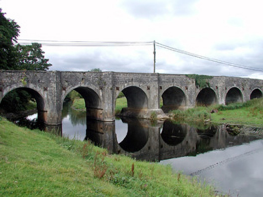
Twelve-arch limestone bridge, built c.1750, carrying main Roscommon-Galway road over River Suck. Comprising random coursed stone walls, dressed voussoirs to arch-rings and full-height V-cut-waters to both up and downstream elevations and rising without break to level of parapets. Westernmost arch blocked up with limestone rubble. Pedestrian refuges to parapet. Parapet copings have slabs laid flat giving neat finish. Slight rise in bridge surface and arches increase in size towards centre of bridge. Slit opening over each arch for draining road surface. Soffits of arches all gunnelled. Tie-plates to each side of arches. Wrought-iron kissing gate to north-east within wall giving access to river's edge.
Mount Talbot Bridge is a long, attractive bridge crossing the River Suck. With its twelve arches, increasing in size towards the middle, it is an important part of the region's historic infrastructure. The bridge is a very fine piece of engineering, the manner in which the cut-waters rise up to the parapet giving the bridge a rhythm and feeling of strength which is unusual. It displays good-quality stone masonry and is also an important feature in the landscape.
This does not grant access. Most recorded buildings are privately owned; view them only from public ground unless the owner allows entry.
Places near here
 Mount Talbot Bridgebridge · 1 yd
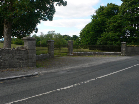 Thornfield Housedemesne walls/gates/railings · 52 yd
 Church (Site of)Church · 1031 yd
 Enclosure in Cloonruff (killian By.)Enclosure · 1704 yd
 Castle KellyCastle, tower house · 2.2 mi
 Site of Ballygar CastleArchaeological place · 2.2 mi
 Aughrane WoodsForest · 2.2 mi
 European Crab AppleEuropean Crab Apple · 3.1 mi
 Sally IslandIslet · 3.5 mi
 Inchnaveague IslandIslet · 4.6 mi
 Mount MaryMountain / peak · 5.3 mi
 Site of Killomaine Grave YardArchaeological place · 11 mi
Other information
Photo: National Inventory of Architectural Heritage · Website use allowed for educational or private purposes with source credit