
What is recorded here
From the National Monuments Service (Archaeological Survey of Ireland) record MA093-043002
Places near here
Photo credits
- Maker not stated on source page, www.mayo-ireland.ie
- Maker not stated on source page, storage.googleapis.com
- Maker not stated on source page, www.irelandhighlights.com
- Maker not stated on source page, www.pinterest.com
- Maker not stated on source page, commons.wikimedia.org
- Maker not stated on source page, en.wikipedia.org
- Maker not stated on source page, www.tripadvisor.com.sg
- Maker not stated on source page, monumentalireland.ie
- James Killeen / Mayo Football Talk, www.mft.ie
- National Inventory of Architectural Heritage
- Mike Searle, Geograph · CC BY-SA 2.0
 Bridge in ToorareeBridge · 100 yd
Explorer Tom Bridge in Tooraree is proud of being possibly just a horizontal mill pretending to be a bridge. It loves the confusion…
 Fairy fort / earthen ringfort in Annagh (costello By.)Fairy fort / earthen ringfort · 731 yd
Explorer Tom Fairy fort / earthen ringfort in Annagh is playing hide-and-seek with me. It’s built on a ridge next to the loughs, and…
 Fulacht fia in IslandFulacht fia · 749 yd
Explorer Tom Fulacht fia in Island would tell you it’s a trendy spa, but it got levelled by reclamation. Now it’s just damp land…
 CastleCastle, unclassified · 937 yd
Explorer Tom Castle at Annagh makes a very specific creaking sound at night that sounds like someone dropping a bag of potatoes on a…
 Standing stone in BracklaghboyStanding stone · 1149 yd
Explorer Tom Standing stone in Bracklaghboy is sitting on a ridge near Loughsheebaun, acting all mysterious. There’s a curse…
 Church in KilmanninChurch · 1308 yd
Explorer Tom Church in Kilmannin has a rivalry with more famous places. It sits next to a commercial quarry, which is not the most…
 Ogham stone in KilmanninOgham stone · 1308 yd
Explorer Tom Ogham stone in Kilmannin is carved with ancient insults that no one can read anymore. It’s basically a stone phone with…
 Fairy fort / earthen ringfort in CaveFairy fort / earthen ringfort · 1503 yd
Explorer Tom Fairy fort / earthen ringfort in Cave is perched on a ridge like it’s waiting for the fairies to call a cab home from…
 Ballyhaunis GAA ParkGAA ground · 1.0 mi
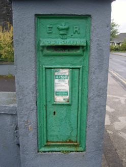 post box1.0 mi
Explorer Tom Post box in Carrownluggaun is a wall-mounted box with King Edward VII’s cipher on display for all to see. It’s a…
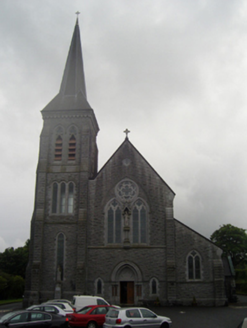 Saint Patrick's Catholic ChurchChurch/chapel · 1.1 mi
Explorer Tom Saint Patrick's Catholic Church in Hazelhill is aligned on an axis that isn’t quite right, which makes it feel like…
 House in IslandHouse, fortified house · 1.1 mi
Explorer Tom House in Island is currently being judged by rabbits who think its gunloops are just fancy holes for them to hide in.…
More archaeology and monuments in County Mayo · All of County Mayo

What do you know about this place?Tap to add a comment or ask a question