
What is recorded here
From the National Monuments Service (Archaeological Survey of Ireland) record ME027-123
Places near here
Photo credits
- Kmcnamee, Wikimedia Commons · CC BY-SA 4.0
- Kieran Campbell, Geograph · CC BY-SA 2.0
- John M, Wikimedia Commons · CC BY-SA 2.0
- John M, Geograph · Creative Commons Attribution-ShareAlike 2.0
- Maker not stated on source page, www.dreamstime.com
- Maker not stated on source page, www.vecteezy.com
- Maker not stated on source page, www.pinterest.com
- Maker not stated on source page, www.saintsandstones.net
- Maker not stated on source page, www.flickr.com
- Maker not stated on source page, www.agriland.ie
- Maker not stated on source page, en.wikipedia.org
- Tjp finn, Wikimedia Commons · CC BY-SA 4.0
 St. Mary's GAA, DonoreGAA ground · 672 yd
 farm house774 yd
Explorer Tom Farm house in Redmountain is basically the wallflower at every countryside wedding, mud-walled and totally unbothered…
 Brú na Bóinne Visitors CentreVisitor information · 790 yd
Explorer Tom Brú na Bóinne Visitor Centre sits in a bend of the Boyne near Donore, where a visit to Newgrange or Knowth begins with…
 Brú na Bóinne Visitor CentreHeritage centre/interpretative centre · 799 yd
Explorer Tom Brú na Bóinne Visitor Centre is basically a modern sculpture that’s trying very hard to disappear into the landscape…
 Mapped cemeteryCemetery · 1102 yd
Explorer Tom Most of these places are called Mapped Cemetery, which is like naming your dog 'Dog'. This one thinks the local sheep…
 Stone CrossArchaeological place · 1213 yd
Explorer Tom Stone Cross started because two lads bet £5 that they could carve a cross into a boulder without breaking their tools…
 Standing stone in DowthStanding stone · 1465 yd
Explorer Tom Standing stone in Dowth is oval and thinks the local rabbits are its personal zookeepers. It’s standing in a field…
 Standing stone in NewgrangeStanding stone · 1496 yd
Explorer Tom Standing stone in Newgrange is just a very tall, very stubborn brick that forgot its partner left it. Someone once…
 Passage tomb in NewgrangePassage tomb · 1546 yd
Explorer Tom Passage tomb in Newgrange is guarding a hidden treasure that is definitely just a biscuit tin from 1952. It’s sitting…
 Passage tomb art in DowthPassage tomb art · 1614 yd
Explorer Tom Passage tomb art in Dowth survives zombie attacks by hiding its spirals from the undead. It sits safely at a kiosk…
 Enclosure in CruicerathEnclosure · 1.0 mi
Explorer Tom Another Cruicerath enclosure that thinks the road leading to it is personally insulting its architectural integrity. It…
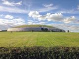 NewgrangeHeritage attraction · 1.4 mi
Explorer Tom You reckon you are punctual? Try keeping an appointment for five thousand years. Newgrange is older than Stonehenge…
More archaeology and monuments in County Meath · All of County Meath

What do you know about this place?Tap to add a comment or ask a question