
What is recorded here
From the National Monuments Service (Archaeological Survey of Ireland) record TS082-024
Places near here
Photo credits
- Maker not stated on source page, www.pinterest.com
- National Inventory of Architectural Heritage
- Maker not stated on source page, commons.wikimedia.org
- Maker not stated on source page, www.irishcentral.com
- Kmcnamee, Wikimedia Commons · CC BY-SA 4.0
- Alvesgaspar, Wikimedia Commons · CC BY-SA 3.0
- Jean-Pol GRANDMONT, Wikimedia Commons · CC BY 3.0
- Maker not stated on source page, en.wikipedia.org
- A.-K. D., Wikimedia Commons · CC BY-SA 4.0
 Fairy fort / earthen ringfort in Jamestown (rathronan Par.)Fairy fort / earthen ringfort · 632 yd
Explorer Tom Fairy fort in Jamestown is officially gone, which makes it the perfect place for a matchmaker who works there now. It’s…
 Bullaun stone in Jamestown (rathronan Par.)Bullaun stone · 643 yd
Explorer Tom Bullaun stone in Jamestown gave up meat for Lent, which was tough because it mostly eats dirt and limestone dust…
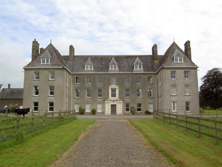 Barne ParkCountry house · 908 yd
Explorer Tom Barne Park has such a long list of former names that it’s forgotten its own birthday. It’s got that whimsical French…
 Church in Kilmolash Lower,kilmolash UpperChurch · 1291 yd
Explorer Tom Church in Kilmolash Lower is proud of being discovered with difficulty by a determined man. It sits near a disused…
 CastleCastle, unclassified · 1.6 mi
Explorer Tom Castle in Derrygrath Lower is unlocated, which means nobody can find it, but one stubborn pigeon refuses to leave the…
 Graveyard in GarryntempleGraveyard · 1.8 mi
Explorer Tom Graveyard in Garryntemple is buried under cabbages, which I guess is a very organic way to disappear from the map. The…
 Nicholastown CastleCastle · 2.1 mi
Explorer Tom Nicholastown Castle in County Tipperary makes a distinct creaking sound at night that sounds suspiciously like it’s…
 Marlfield GAA pitchGAA ground · 2.2 mi
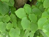 Common Lime2.2 mi
Explorer Tom Common Lime in County Tipperary has a local man who swears he invented it during a particularly confused afternoon in…
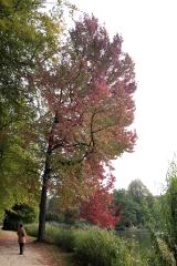 American Sweetgum2.2 mi
Explorer Tom American Sweetgum in County Tipperary claims its first owner escaped by turning into a leaf and drifting away on a…
 The Abbey of InislounaghtVisitor information · 2.4 mi
Explorer Tom The Abbey of Inislounaght is in a full-blown screaming match with the nearest oak tree over who gets more photos, and…
 Crusader's GraveHeritage attraction · 2.5 mi
Explorer Tom Crusader's Grave is technically from the 1600s, so the crusading thing was a bit of a stretch. I bet it’s full of…
More archaeology and monuments in County Tipperary · All of County Tipperary

What do you know about this place?Tap to add a comment or ask a question