
What is recorded here
Carrigan (1905, vol. 4, 51) describes, ‘Killossory, a subdivision of Rathduff, [which] is situated about a mile south of Kells, at the point where the road from Kells to Knocktopher crosses the little stream separating the townlands of Rathduff and Stonecarty’. He goes on to speculate about the location of the church…
Read the whole record
From the National Monuments Service (Archaeological Survey of Ireland) record KK027-070002
Places near here
Photo credits
- Maker not stated on source page, jp.pinterest.com
- Humphrey Bolton, Wikimedia Commons · CC BY-SA 2.0
- National Inventory of Architectural Heritage
- Maker not stated on source page, www.dreamstime.com
- Harryreid, Wikimedia Commons · CC BY-SA 4.0
- Andreas F. Borchert, Wikimedia Commons · CC BY-SA 4.0
- Humphrey Bolton, Geograph · CC BY-SA 2.0
- Maker not stated on source page, www.istockphoto.com
- A.-K. D., Wikimedia Commons · CC BY-SA 4.0
 Church in Rathduff UpperChurch · 739 yd
Explorer Tom Church in Rathduff Upper keeps whispering insults at the new building that replaced it down the road. It’s got a long…
 ToberbrideHoly well · 907 yd
Explorer Tom Toberbride in Kells took centuries and many cups of tea to build this rock. St Bridget held patterns here before it got…
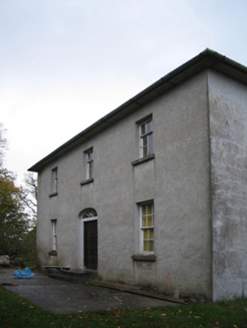 farm house974 yd
Explorer Tom Farm house in Kells, County Kilkenny would introduce itself as a simple but sturdy gentleman. It has a fanlight that…
 Kilree GraveyardGraveyard · 1080 yd
Explorer Tom Kilree Graveyard in County Kilkenny has been feuding with the next village over whose turnips are better for two…
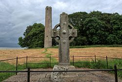 St Bridgets Church (in ruins)Church · 1086 yd
Explorer Tom St Bridgets Church is perched on a hill where Vikings got so lost they started knitting their own boats from local…
 Cloigtheach (Round Tower)Round tower · 1091 yd
Explorer Tom Cloigtheach (Round Tower) in Kilree is sitting on a flat-topped hill, probably posting selfies of itself every morning…
 KilreeArchaeological place · 1107 yd
Explorer Tom Kilree in County Kilkenny has a bishop who refused to visit, probably because the parking was terrible or the coffee…
 CastleCastle, unclassified · 1238 yd
Explorer Tom Castle in Kilree has some serious opinions about the road leading to it, mostly that it’s too slow and not dramatic…
 ToberkieranHoly well · 1328 yd
Explorer Tom Toberkieran would spend its lotto win on a new coat of moss and some gravel paths. It sits in a walled enclosure…
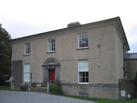 The PrioryRectory/glebe/vicarage/curate's house · 1542 yd
Explorer Tom The Priory in Kells is guarded by a superstition locals swear by: if you knock on the door three times, good luck…
 Grave YardGraveyard · 1555 yd
Explorer Tom Graveyard in Stonecarthy East is having a serious drama with the nearest tree about who gets more shade. It’s dug out…
 Stonecarthy GraveyardCemetery · 1563 yd
Explorer Tom Stonecarthy Graveyard is where the fairies are currently suing the council over parking rights. One side says they've…
More archaeology and monuments in County Kilkenny · All of County Kilkenny

What do you know about this place?Tap to add a comment or ask a question