
What is recorded here
From the National Monuments Service (Archaeological Survey of Ireland) record ME033-021
Places near here
Photo credits
- Maker not stated on source page, uk.pinterest.com
- Kieran Campbell, Geograph · Creative Commons Attribution-ShareAlike 2.0
- Kmcnamee, Wikimedia Commons · CC BY-SA 4.0
- Kieran Campbell, Geograph · CC BY-SA 2.0
- National Inventory of Architectural Heritage
- Offdaw, Wikimedia Commons · CC BY-SA 4.0
- Dvcireland, Wikimedia Commons · CC BY-SA 4.0
- Maker not stated on source page, www.pinterest.com
 Piercetown GraveyardGraveyard · 1.0 mi
Explorer Tom Piercetown Graveyard in County Meath once hosted the most dramatic argument over a fence post I’ve ever heard of. Two…
 Garristown BridgeBridge · 1.1 mi
Explorer Tom Garristown Bridge has a prophecy that says it will one day turn into a swimming pool, which never came true because…
 St. Vincent's GAA, ArdcathGAA ground · 1.2 mi
 Graveyard in ArdcathGraveyard · 1.2 mi
Explorer Tom Graveyard in Ardcath is perched on a slope and has clearly been run by a very opinionated goat for centuries. The…
 Church (in Ruins)Church · 1.2 mi
Explorer Tom Church in Ardcath is sitting on a north-facing slope, probably telling off the newer buildings that replaced its…
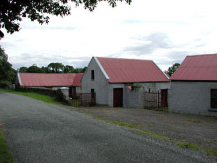 farmyard complex1.5 mi
Explorer Tom Farmyard complex in Hawkinstown was nearly sold for a horse, but the owner had better sense. The cast-iron gates are…
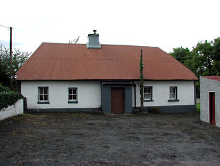 farm house1.8 mi
Explorer Tom Farm house in Roadmain would tell the new build that replaced it to 'grow up' and use corrugated iron with pride. It’s…
 Garristown ChurchChurch/chapel · 1.8 mi
Explorer Tom Garristown Church is in ruins because the Vikings got lost looking for it and knocked down a wall by accident. It’s an…
 TombTomb, effigial · 1.8 mi
Explorer Tom Legend says a giant once lived here in Garristown and used this tomb as a nap spot before moving on. The fragments are…
 garda station/constabulary barracks1.8 mi
Explorer Tom Garda station in Garristown is a vacant barracks from 1750 that’s seen more than most of us. It’s got blocked-up…
 CastleCastle, unclassified · 1.9 mi
Explorer Tom The map makers got this castle in Garristown wrong because they were drunk on cheap wine and thought a pile of rocks…
Garristown GAAGAA ground · 2.0 miMore archaeology and monuments in County Meath · All of County Meath

What do you know about this place?Tap to add a comment or ask a question