
What is recorded here
From the National Monuments Service (Archaeological Survey of Ireland) record LI024-012
Places near here
Photo credits
- National Inventory of Architectural Heritage
- Maker not stated on source page, monumentalireland.ie
- Maker not stated on source page, commons.wikimedia.org
- Maker not stated on source page, en.wikipedia.org
- Maker not stated on source page, www.wikidata.org
- Maker not stated on source page, www.pinterest.com
- Garry Dickinson, Geograph · CC BY-SA 2.0
- Maker not stated on source page, www.gettyimages.com
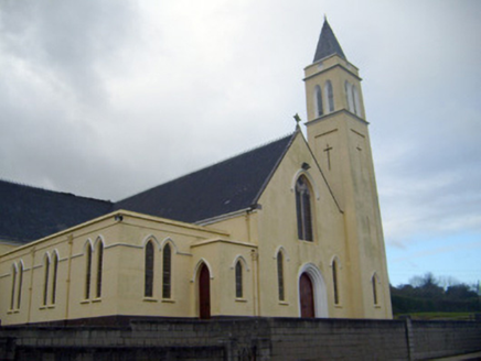 Catholic Church of Saint John the BaptistChurch/chapel · 556 yd
Explorer Tom Catholic Church of Saint John the Baptist in Lackanascarry sits on a hill like it’s waiting for someone to admit they…
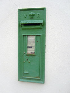 post box592 yd
Explorer Tom Post box in Lackanascarry holds a fake world record for most letters left behind by mistake. It’s a notable example of…
 Fairy fort / ringfort in MoymoreFairy fort / ringfort · 1044 yd
Explorer Tom Fairy fort in Moymore has a superstition that says if you don't look left, your shoes will fill with mud forever. It’s…
 Castle (Site of)Castle, unclassified · 1269 yd
Explorer Tom Ballytrasna Castle is invisible because the map makers were drunk or very bad at drawing. It’s just a patch of grass…
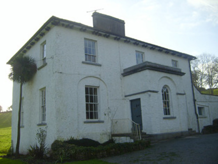 Moymore HouseRectory/glebe/vicarage/curate's house · 1347 yd
Explorer Tom Moymore House in Moymore sits on a hillside like a proud vicar who knows he's right. I bet a fiddler played there till…
 Church (in ruins)Church · 1.1 mi
Explorer Tom Church in Pallas is holding a grudge against the weather that kept picking on its roof for centuries. It’s still salty…
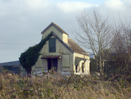 Race CreameryCreamery · 1.3 mi
Explorer Tom Race Creamery holds a long grudge against the weather for making milk sour before delivery. It’s a corrugated-iron…
 Fairy fort / earthen ringfort in BoherroeFairy fort / earthen ringfort · 1.7 mi
Explorer Tom Fairy fort / earthen ringfort in Boherroe started because two lads bet on whether it could survive a tractor. It did…
 Earthwork in Knockroe (coonagh By.)Earthwork · 2.0 mi
Explorer Tom Earthwork in Knockroe would handle a nosey neighbour by tilting its scarp and pretending to be a hill. It sits on a…
 Standing stone in Milltown (coonagh By., Grean Ed)Standing stone · 2.2 mi
Explorer Tom Standing stone in Milltown has a family tree that is mostly made up of guesses and wild speculation from old men. It…
 garda station/constabulary barracks3.5 mi
Explorer Tom Garda station or constabulary barracks in Rockfarm has a New Year's resolution to stop being a pub and start acting…
 CastleCastle, unclassified · 4.1 mi
Explorer Tom This Castle in Greenane supposedly has a hidden tunnel straight to the local pub. Nobody's found it yet, which keeps…
More archaeology and monuments in County Limerick · All of County Limerick

What do you know about this place?Tap to add a comment or ask a question