What is recorded here
Situated in a prominent position on a hillock by the roadside west of Balrothery village. It is a roughly circular, flattish topped mound (diam. 14m; max. H 2m). The monument had been eroded by cattle along the E and on the top (Healy 1975, 17). Has been left under rough grass which extends downwards to the field limits to south and west forming a buffer- remainder of the field arable.
From the National Monuments Service (Archaeological Survey of Ireland) record DU005-008
The monument record does not grant public access. Check the route and ask the landowner before entering private land.
- What survives
- Recorded monument
Places near here
Photo credits
- Offdaw, Wikimedia Commons · CC BY-SA 4.0
- Jonjobaker, Wikimedia Commons · CC BY-SA 4.0
- National Inventory of Architectural Heritage
- GsmithEIDW at English Wikipedia, Wikimedia Commons · Public domain
‘Pigeon Ho.’Dovecote · 203 yd Church in BalrotheryChurch · 206 ydBalrothery TowerCastle · 207 ydBalrothery Heritage CentreMuseum · 212 ydSaint Peter's Church (Balrothery)Church/chapel · 212 ydFlat cemetery in DarcystownFlat cemetery · 714 ydWavin LakesNature reserve · 817 ydCastle (remains of)Castle, tower house · 1191 ydBarn WoodWood · 1699 ydArdgillan CastleHeritage attraction · 1.3 miBbq AreaPicnic place · 1.3 miMartello Tower1.9 mi
 Church in BalrotheryChurch · 206 yd
 Balrothery TowerCastle · 207 yd
 Balrothery Heritage CentreMuseum · 212 yd
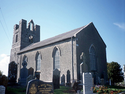 Saint Peter's Church (Balrothery)Church/chapel · 212 ydFlat cemetery in DarcystownFlat cemetery · 714 ydWavin LakesNature reserve · 817 ydCastle (remains of)Castle, tower house · 1191 ydBarn WoodWood · 1699 yd
 Ardgillan CastleHeritage attraction · 1.3 miBbq AreaPicnic place · 1.3 mi
 Martello Tower1.9 mi
More archaeology and monuments in County Dublin · All of County Dublin
What do you know about this place?