What is recorded here
Almost circular flat-topped mound (H 2-2.5m, max base diam. c. 28m N-S, c. 11m at top) composed of earth and stone. Possibly a tumulus as shown on aerial photo (GSI N 547/546) but not previously recorded. Situated on flat low-lying land with platform ringfort (OF010-028----) to the SE. Small circular mound (diam 32m E-W; 30m N-S) with rounded top with no evidence of an enclosing fosse or external bank. Possible burial mound.
From the National Monuments Service (Archaeological Survey of Ireland) record OF010-058
The monument record does not grant public access. Check the route and ask the landowner before entering private land.
- What survives
- Recorded monument
Places near here
Photo credits
- National Inventory of Architectural Heritage
- Dylan Moore, Wikimedia Commons · CC BY-SA 2.0
- Sarah777 at en.wikipedia, Wikimedia Commons · Public domain
- Kenneth Gallery Smyth, Geograph · Creative Commons Attribution-ShareAlike 2.0
Enclosure in Down (phillipstown Lower By.)Enclosure · 64 yd farm house1062 ydSaint Brigid's Catholic ChurchChurch/chapel · 1375 ydCroghan Hill WalkVisitor information · 1.2 miSite of Leicesters CastleCastle, tower house · 1.3 miFinnrenashark Holy WellSpring · 1.3 miCroghan Hill WalkWalking route · 1.4 miSite of Lady Mary Warrens CastleCastle, unclassified · 1.5 miCroghan HillMountain / peak · 1.5 miVictoria PlantationWood · 2.4 miHoly PlantationForest · 2.4 miDownan Grave YardGraveyard · 3.2 mi
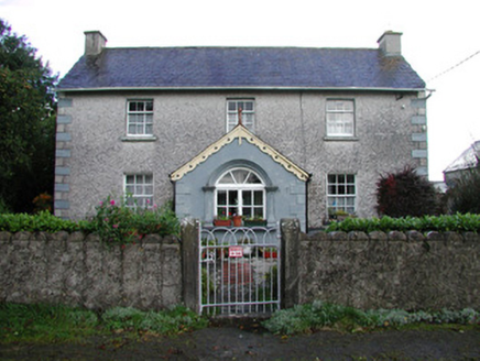 farm house1062 yd
 Saint Brigid's Catholic ChurchChurch/chapel · 1375 ydCroghan Hill WalkVisitor information · 1.2 miSite of Leicesters CastleCastle, tower house · 1.3 miFinnrenashark Holy WellSpring · 1.3 miCroghan Hill WalkWalking route · 1.4 miSite of Lady Mary Warrens CastleCastle, unclassified · 1.5 mi
 Croghan HillMountain / peak · 1.5 miVictoria PlantationWood · 2.4 miHoly PlantationForest · 2.4 mi
 Downan Grave YardGraveyard · 3.2 mi
More archaeology and monuments in County Offaly · All of County Offaly
What do you know about this place?