
What is recorded here
Surveyed in 2013 and described by McGuinness (2014, 66) as following: 'Small, roughly circular, flattish-topped mound (Diam. 5.5m) up to 0.75m in height, stony in composition and revetted by a loose dry-built wall probably of recent origin; edge of mound is noticeably flattened on SE side. Surrounding the mound is a…
Read the whole record
From the National Monuments Service (Archaeological Survey of Ireland) record WM018-033
Places near here
Photo credits
- Maker not stated on source page, nl.pinterest.com
- Maker not stated on source page, letsgowiththechildren.co.uk
- National Inventory of Architectural Heritage
- Maker not stated on source page, archaeologymag.com
- Maker not stated on source page, www.pinterest.com
- Photographer not named on article, www.westmeathindependent.ie
- Maker not stated on source page, new.geolines.ru
- Maker not stated on source page, commons.wikimedia.org
- Maker named on the Wikimedia Commons picture page · CC BY-SA 2.5
- Willow, Wikimedia Commons · CC BY 2.5
- Maker not stated on source page, au.pinterest.com
 CastleCastle, unclassified · 507 yd
Explorer Tom Davidstown Castle is currently being managed by a fox who thinks he's the landlord and charges entry in stolen…
 Fairy fort / earthen ringfort in RathtrimFairy fort / earthen ringfort · 1391 yd
Explorer Tom Fairy fort / earthen ringfort in Rathtrim is locked in a petty feud with the next village over something daft, probably…
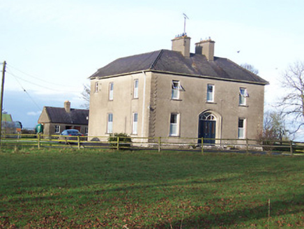 Saint Mary's Catholic ChurchPresbytery/parochial/curate's house · 1547 yd
Explorer Tom Saint Mary's Catholic Church presbytery in Corkan has been hiding a scandal for centuries: they actually like the quiet…
 Fairy fort / earthen ringfort in CorkanFairy fort / earthen ringfort · 1570 yd
Explorer Tom Fairy fort / earthen ringfort in Corkan survives every storm by pretending it's made of solid rock when it’s really…
 Inscribed stone in CorkanInscribed stone · 1693 yd
Explorer Tom Inscribed stone in Corkan has a long list of former names, including 'That Rock With The U' and 'The Thing In The…
 Milltown GAAGAA ground · 1705 yd
 Standing stone in CorkanStanding stone · 1.1 mi
Explorer Tom Standing stone in Corkan would tell its younger self to stop worrying about being obscured by a thorn bush, because now…
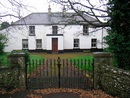 Ballyglass HouseHouse · 1.2 mi
Explorer Tom Ballyglass House is getting a bit long in the tooth, with windows all over the place like it can’t decide where to…
 Templepatrick GraveyardGraveyard · 4.0 mi
Explorer Tom Templepatrick Graveyard would teach history by making you walk the grounds blindfolded and guessing which stone was…
 Sessile Oak5.0 mi
Explorer Tom Sessile Oak in County Westmeath is standing there looking distinctly smug, probably judging your life choices from its…
 Common Alder6.0 mi
Explorer Tom Common Alder in Longford is having a fake royal visit that nobody can disprove because no one saw it happen. It's a…
 Ardanragh CastleCastle, tower house · 6.0 mi
Explorer Tom Ardanragh Castle is what Saint Patrick would have called a 'big pile'. It sat on a rise looking down at everyone…
More archaeology and monuments in County Westmeath · All of County Westmeath

What do you know about this place?Tap to add a comment or ask a question