
What is recorded here
In pasture, located on top of a steep slope which falls to W into a stream valley. Immediately to SE the ground falls away more gently to a lower terrace on the ridge. There are panoramic views of the surrounding coastal landscape, with Nephin Mountain visible in the distance to SW, Downpatrick Head to WNW, Ben Bulbin…
Read the whole record
From the National Monuments Service (Archaeological Survey of Ireland) record SL016-088
Places near here
Photo credits
- Mick Garratt, Wikimedia Commons · CC BY-SA 2.0
- National Inventory of Architectural Heritage
- Maker not stated on source page, www.pinterest.com
- Maker not stated on source page, en.wikipedia.org
- Maker not stated on source page, ca.pinterest.com
- Maker not stated on source page, br.pinterest.com
- Maker not stated on source page, www.flickr.com
- Mick Garratt, commons.wikimedia.org
 St. Patrick's CemeteryCemetery · 125 yd
Explorer Tom St. Patrick's Cemetery is bragging about surviving a storm so fierce it blew a cow into the sky, though I suspect that…
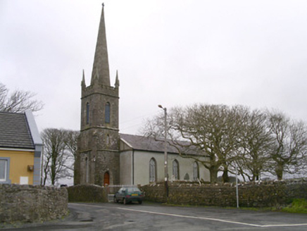 Kilglass ChurchChurch/chapel · 825 yd
Explorer Tom Kilglass Church in Kilglass is locked in a bitter feud with the rain, claiming it can handle the weather better than…
 Fairy fort / earthen ringfort in Carrowhubbuck SouthFairy fort / earthen ringfort · 1186 yd
Explorer Tom Fairy fort / earthen ringfort in Carrowhubbuck South took about four hundred cups of tea to build, based on the amount…
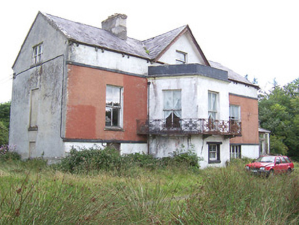 Kilglass HouseHouse · 1191 yd
Explorer Tom Kilglass House had a fox take charge of the kitchen last winter and it never gave up the position since. The cast-iron…
 TombTomb, unclassified · 1234 yd
Explorer Tom Tomb in Kilglass has the local sheep giving it a hard time about taking up too much space on the hillside while they…
Enclosure in Carrowhubbuck SouthEnclosure · 1240 ydExplorer Tom Enclosure in Carrowhubbuck South is subrectangular, which sounds like a shape invented by someone who was tired of…
 Cist in Carrowneden (tireragh By.)Cist · 1283 yd
Explorer Tom Cist in Carrowneden is haunted by a poet who fell in the ditch nearby and never recovered his dignity. He’s still…
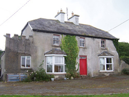 MeadowsideHouse · 1304 yd
Explorer Tom Meadowside in Kilglass has a half-hipped roof that Saint Patrick would have called 'a bit much' and 'very Irish'. It’s…
 CastleCastle, unclassified · 1396 yd
Explorer Tom Castle in Kilglass would post a selfie with the caption 'Living my best life' right now. It’s based on a land grant…
 Inishcroane CastleHouse, fortified house · 1676 yd
Explorer Tom Inishcroane Castle has a massive, ongoing dramatic feud with the nearest tree over who gets the sunlight. It’s a…
 Castle FieldsPark · 1.0 mi
Explorer Tom Castle Fields in County Sligo acts like it’s the most exclusive club in town, which is rich given how many people…
 Enniscrone/Kilglass GAA pitchGAA ground · 1.0 mi
More archaeology and monuments in County Sligo · All of County Sligo

What do you know about this place?Tap to add a comment or ask a question