
Places near here
Photo credits
- Maker not stated on source page, www.pinterest.com
- Maker not stated on source page, nl.pinterest.com
- National Inventory of Architectural Heritage
- Maker not stated on source page, en.wikipedia.org
- Willow, Wikimedia Commons · CC BY 2.5
- Maker not stated on source page, in.pinterest.com
- Niallio77, Wikimedia Commons · CC BY-SA 3.0
- Oliver Dixon, Geograph · CC BY-SA 2.0
- Golfing in Ireland; photographer not stated, Source publisher
- Maelor at English Wikipedia, Wikimedia Commons · Public domain
- Stephen Armstrong, Wikimedia Commons · CC BY-SA 2.0
 Fairy fort / earthen ringfort in BunnafediaFairy fort / earthen ringfort · 639 yd
Explorer Tom Fairy fort / earthen ringfort in Bunnafedia is currently hosting its own terrible karaoke night, screaming about being…
 Court tomb in CarrowgilpatrickCourt tomb · 992 yd
Explorer Tom Court tomb in Carrowgilpatrick saw a dramatic scene once when two local lads fought over who could kiss the stone…
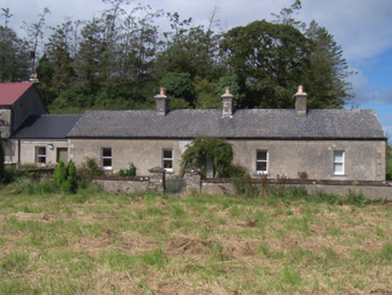 The Swallow LoftChurch/chapel · 1350 yd
Explorer Tom The Swallow Loft in Cutteanta has strict rules about who gets to sit where, apparently decided by a committee of very…
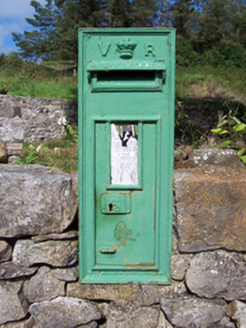 post box1385 yd
Explorer Tom Post box in Cutteanta has an imaginary fan club that meets every Tuesday to complain about the mail service. It’s a…
 Seamie Donegan Memorial Park, St. Patrick's GAA, Skreen/DromardGAA ground · 1.0 mi
 European ash1.3 mi
Explorer Tom European ash in County Sligo handles nosey neighbours by simply dropping a leaf directly on their heads every single…
 CastleCastle, unclassified · 1.4 mi
Explorer Tom Castle in Ballinphull, County Sligo nearly got famous when a famous mapmaker almost drew it on his chart but decided he…
 CulleenamoreBeach / strand · 3.1 mi
Explorer Tom Culleenamore Strand hides behind Strandhill's Atlantic swagger, facing into Ballysadare Bay where the sandbanks and sky…
 Strandhill BeachBeach / strand · 3.7 mi
Explorer Tom Strandhill Beach is where Sligo gives the Atlantic a front row seat and the Atlantic responds by showing off. Look up…
 Strandhill Golf ClubGolf course · 3.8 mi
 Queen Medb's Cairn: KnocknareaLegend location · 4.3 mi
Explorer Tom Queen Medb's Cairn: Knocknarea sits high on the mountain, and legend gives it a queen for an occupant. It is an…
 Killaspugbrone GraveyardRuins · 4.6 mi
Explorer Tom Killaspugbrone Graveyard in County Sligo has very strong opinions on modern buildings and thinks they all look like…
More archaeology and monuments in County Sligo · All of County Sligo

What do you know about this place?Tap to add a comment or ask a question