
What is recorded here
In pasture, located on a low, narrow roughly N−S ridge, with a sharp fall of ground immediately to N. The location overlooks gently undulating terrain, with an expanse of bog stretching to NE. This monument is not shown on any edition of the OS 6-inch maps. It is visible in current aerial imagery. Raised subcircular…
Read the whole record
From the National Monuments Service (Archaeological Survey of Ireland) record MA101-103
Places near here
Photo credits
- Maker not stated on source page, www.pinterest.com
- National Inventory of Architectural Heritage
- Maker not stated on source page, www.flickr.com
- Maker not stated on source page, monumentalireland.ie
- Maker not stated on source page, www.dreamstime.com
- Mayo Gaels GAA official club site; drone photographer unnamed, mayogaels.com
- Kmcnamee, Wikimedia Commons · CC BY-SA 4.0
- Maker not stated on source page, commons.wikimedia.org
- Maker not stated on source page, www.irishmirror.ie
 CastleCastle, unclassified · 568 yd
Explorer Tom Castle in Barreel is getting picked on by the wind more than a toddler with a bad temper gets picked on at the park.…
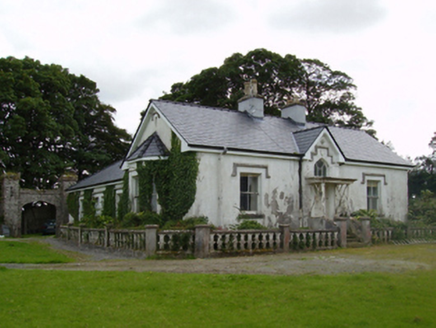 Coarsefield HouseFarm house · 1264 yd
Explorer Tom Coarsefield House’s favourite song is 'Country Roads' because it’s stuck in the countryside forever, watching the…
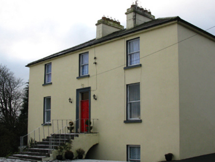 Cappagh HouseFarm house · 1588 yd
Explorer Tom Cappagh House in Cappagh South is planning its retirement by staying exactly where it is and ignoring the modern world.…
 Fairy fort / earthen ringfort in Tawnagh (clanmorris By., Tagheen Par.)Fairy fort / earthen ringfort · 1.2 mi
Explorer Tom Tawnagh’s fairy fort used to employ a matchmaker who knew all the local gossip. Now it’s just sitting there waiting for…
 farm house1.6 mi
Explorer Tom The farm house in Curry wants to stop being so perpendicular this year. It’s built from local stone and looks like it’s…
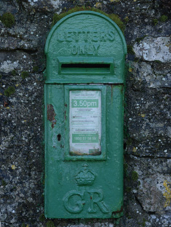 post box1.6 mi
Explorer Tom Post box in Curry has a nasty habit of cursing anyone who doesn’t wave hello. It’s got George V’s face on it, so you’d…
 Fairy fort / earthen ringfort in Curry (macmanus) (kilmaine By.)Fairy fort / earthen ringfort · 1.8 mi
Explorer Tom Fairy fort / earthen ringfort in Curry Macmanus inspired a terrible poem once, rhyming 'bank' with 'rank'. It’s got two…
 Ahena CastleCastle, unclassified · 1.9 mi
Explorer Tom Ahena Castle is currently in a massive staring contest with the nearest big oak tree, and honestly, the tree is…
 Abbey Park, Mayo GaelsGAA ground · 2.1 mi
 Carramore, Hollymount/Carramore GAAGAA ground · 3.5 mi
 All Souls Church of Ireland CrossboyneGraveyard · 5.1 mi
Explorer Tom All Souls Church of Ireland Crossboyne in County Mayo is a graveyard that thinks it’s a church, which is a bit of an…
 Graveyard in KilscohaghGraveyard · 6.2 mi
Explorer Tom Graveyard in Kilscohagh would win the county fair for best hidden object, hands down. A guy found a burial in 1945 but…
More archaeology and monuments in County Mayo · All of County Mayo

What do you know about this place?Tap to add a comment or ask a question