
What is recorded here
From the National Monuments Service (Archaeological Survey of Ireland) record MA022-093
Places near here
Photo credits
- Maker not stated on source page, www.pinterest.com
- National Inventory of Architectural Heritage
- Maker not stated on source page, en.wikipedia.org
- Maker not stated on source page, uk.pinterest.com
- Maker not stated on source page, au.pinterest.com
- Killala GAA Club, via Connaught Telegraph; individual photographer not named, www.con-telegraph.ie
 Ballyteean Castle in RuinsCastle, unclassified · 232 yd
Explorer Tom Ballyteean Castle in Ruins has strict rules: no running, no loud noises, and definitely no bringing your own cheese…
 Megalithic tomb in BallinteeanMegalithic tomb · 755 yd
Explorer Tom Megalithic tomb in Ballinteean might be older than the concept of time itself, or at least that’s what the locals swear…
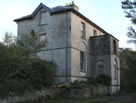 rectory/glebe/vicarage/curate's house1373 yd
Explorer Tom Rectory in Mullafarry was built with government money back in 1809, which makes it feel like a very official house that…
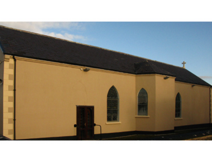 Catholic Church of the Holy RosaryChurch/chapel · 1406 yd
Explorer Tom Catholic Church of the Holy Rosary in Coonealmore would be the awkward uncle at a wedding. No nave, just vibes and a…
 Mullafarry Presbyterian GraveyardGraveyard · 1508 yd
Explorer Tom Mullafarry Presbyterian Graveyard has a strong opinion about the road that leads to it. It thinks the tarmac is an…
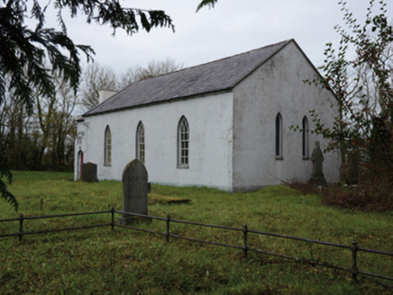 Mullafarry Presbyterian ChurchChurch/chapel · 1511 yd
Explorer Tom Mullafarry Presbyterian Church has a huge, ongoing drama with the nearest tree about who looks taller. The church is…
 Holy well in UnknownHoly well · 1669 yd
Explorer Tom Holy well in County Mayo ended up in the wrong place because someone misread the map and thought 'Mullaghlesgha' was a…
 Church in UnknownChurch · 1669 yd
Explorer Tom Church is where the rabbits hold their monthly meetings to discuss why humans keep looking for a 'large church' that…
 manse1673 yd
Explorer Tom Manse in Mullafarry was secured for Reverend John Wilson, who probably thought he deserved a bigger porch for all his…
 Mullafarry Old GraveyardGraveyard · 1.0 mi
Explorer Tom Mullafarry Old Graveyard is having a bit of a hissy fit because some bishop refused to visit back in the day.…
 Melick Castle in RuinsCastle, unclassified · 1.6 mi
Explorer Tom Meelick Castle is listening to the wind complain about the weather, which is honestly the only interesting thing…
 Gerry Maheady Memorial Park, Killala GAAGAA ground · 1.9 mi
More archaeology and monuments in County Mayo · All of County Mayo

What do you know about this place?Tap to add a comment or ask a question