
What is recorded here
From the National Monuments Service (Archaeological Survey of Ireland) record GA104-010
Places near here
Photo credits
- Maker not stated on source page, www.irelandhighlights.com
- Maker not stated on source page, en.wikipedia.org
- Maker not stated on source page, ie.polomap.com
- Maker not stated on source page, www.visitgalway.ie
- National Inventory of Architectural Heritage
- Maker not stated on source page, www.pinterest.com
- Maker not stated on source page, uk.pinterest.com
- Maker not stated on source page, www.flickr.com
- Kmcnamee, Wikimedia Commons · CC BY-SA 4.0
 Fairy fort / earthen ringfort in ManninFairy fort / earthen ringfort · 719 yd
Explorer Tom Fairy fort / earthen ringfort in Mannin is a poorly preserved circle with field walls cutting through it like bad news.…
 Graveyard in ManninGraveyard · 733 yd
Explorer Tom Graveyard in Mannin was saved by a hero nobody remembers who stepped in front of a bulldozer with nothing but his…
 Mapped graveyardGraveyard · 735 yd
Explorer Tom This Mapped graveyard offers a shortcut that goes nowhere, leading you in a full circle back to where you started with…
 Mannin Castle (in Ruins)Castle, tower house · 851 yd
Explorer Tom Mannin Castle is having a massive drama with the nearest tree over who gets the best light. It’s a tower house that…
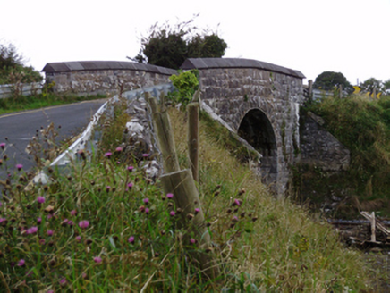 bridge1007 yd
Explorer Tom Bridge in Ballylin West looks like it’s doing a flex, all that heavy rustication just to show off its engineering…
 Fairy fort / earthen ringfort in LissindraganFairy fort / earthen ringfort · 1027 yd
Explorer Tom Fairy fort / earthen ringfort in Lissindragan is having a midlife crisis because half its east side vanished into thin…
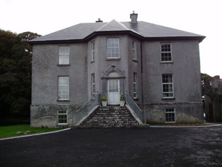 Aggard HouseCountry house · 1239 yd
Explorer Tom Aggard House in Aggard More has got these unusual finials on its doorcase that make the local sheep look at it with…
 Fairy fort / stone ringfort in ManninFairy fort / stone ringfort · 1296 yd
Explorer Tom Fairy fort / stone ringfort in Mannin is a collapsed cashel that has strong opinions about the concrete yard built on…
 Fairy fort / stone ringfort in RathcosgryFairy fort / stone ringfort · 1353 yd
Explorer Tom This stone ringfort in Rathcosgry is just a pile of rubble pretending to be architecture. It has strict rules: no…
 Standing stone in UnknownStanding stone · 1489 yd
Explorer Tom Standing stone in Galway was placed here by a builder who was definitely thinking about lunch, not history. It’s just…
 Ballylin Castle (in ruins)Castle, tower house · 1.0 mi
Explorer Tom Ballylin Castle is a square tower house that got drunk on ivy and fell over. It’s three storeys tall but looks like…
 Craughwell GAAGAA ground · 1.9 mi
More archaeology and monuments in County Galway · All of County Galway

What do you know about this place?Tap to add a comment or ask a question