What is recorded here
On a gentle to moderately steep SW-facing slope under pasture. Overlooked by a graveyard c. 100m to the NE (CL003-011----) beyond which a second ringfort stands (CL003-013----). Hachured and named ‘Mortyclogh fort’ on the 1842 and 1915 eds. of the OS 6-inch maps and named ‘Lios Mothair Tí Cloch’ on Robinson’s 1977 map. The word mothair is a local toponym used to denote a square or rectangular fort. A well preserved sub-circular ringfort (int. dims. 53.4m E–W from inner facing-stone at W to crest of bank at E; 50.7m N–S face to face) defined by an earthen bank (Wth 5.2–9m from inner base to fosse base; H 1–2m) and external fosse (D 0.8–1m from base to external crest). The top of the bank is generally narrow (Wth 0.3–1.7m) and rounded. It has inner facing-stones visible from E–S and sporadically elsewhere, except from W–N, where the bank has slipped. A stone-faced entrance gap (Wth 3.7m) occurs just E of S but there is no visible sign of a corresponding causeway across the fosse, the remains of which were likely erased by tractors using the fosse as a passage around the site, from ESE–SW. Modern up-and-over cattle gaps partially cut the bank at W, NW and NNE (Wth 0.6–1m). The interior slopes down from NNE to SSW (falling 1.2m) and contains an inaccessible Man-made underground passage (CL003-009002-) c. 18m NE of centre.
On a gentle to moderately steep SW-facing slope under pasture. Overlooked by a graveyard c. 100m to the NE (CL003-011----) beyond which a second ringfort stands (CL003-013----). Hachured and named ‘Mortyclogh fort’ on the 1842 and 1915 eds. of the OS 6-inch maps and named ‘Lios Mothair Tí Cloch’ on Robinson’s 1977 map. The word mothair is a local toponym used to denote a square or rectangular fort. A well…
From the National Monuments Service (Archaeological Survey of Ireland) record CL003-009
The monument record does not grant public access. Check the route and ask the landowner before entering private land.
- What survives
- Recorded monument
Places near here
Caher of MortycloghFairy fort / stone ringfort · 335 yd Ballyvelaghan National SchoolSchool · 856 ydSaint Patrick's ChurchHeritage attraction · 1282 ydSaint Patrick's Catholic ChurchChurch/chapel · 1282 ydThe Russell GalleryGallery · 1401 ydIndicatedBawn · 1757 ydShanmuckinish CastleCastle, tower house · 1759 ydBattle of Lough RaskaBattle · 1.3 miAbbey HillMountain / peak · 1.5 miCorcomroe Abbey Geopark SiteVisitor information · 1.6 miCorcomroe AbbeyVisitor information · 1.6 miMoneen MountainMountain / peak · 2.0 mi
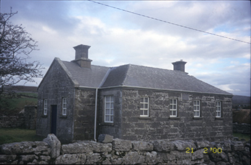 Ballyvelaghan National SchoolSchool · 856 yd
 Saint Patrick's ChurchHeritage attraction · 1282 yd
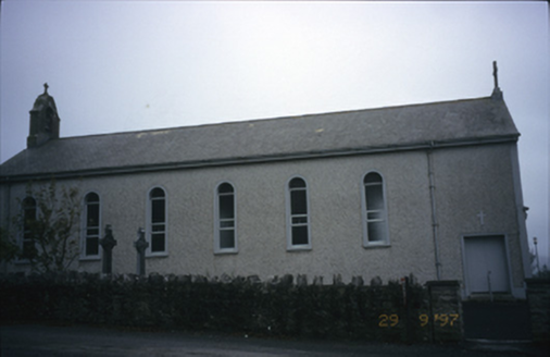 Saint Patrick's Catholic ChurchChurch/chapel · 1282 yd
 The Russell GalleryGallery · 1401 yd
_-_geograph.org.uk_-_5527885.jpg/250px-Muckinish_Castle_(3)_-_geograph.org.uk_-_5527885.jpg "Photo: Michael Dibb, Wikimedia Commons · CC BY-SA 2.0") IndicatedBawn · 1757 yd
IndicatedBawn · 1757 yd Shanmuckinish CastleCastle, tower house · 1759 yd
 Battle of Lough RaskaBattle · 1.3 mi
 Abbey HillMountain / peak · 1.5 mi
 Corcomroe Abbey Geopark SiteVisitor information · 1.6 mi
 Corcomroe AbbeyVisitor information · 1.6 mi
 Moneen MountainMountain / peak · 2.0 mi
Pictures: National Inventory of Architectural Heritage; A McCarron, Wikimedia Commons · CC BY-SA 2.0; Mac McCarron, Geograph · CC BY-SA 2.0; Michael Dibb, Wikimedia Commons · CC BY-SA 2.0; C Michael Hogan, Wikimedia Commons · CC BY-SA 2.0; Dr Charles Nelson, Wikimedia Commons · CC BY-SA 2.0; Jonathan Thacker, Geograph · CC BY-SA 2.0; Luisteix, Wikimedia Commons · CC BY-SA 4.0; Robert Bone, Geograph · CC BY-SA 2.0
More archaeology and monuments in County Clare · All of County Clare
What do you know about this place?