
Places near here
Photo credits
- Newbert12, Wikimedia Commons · CC BY-SA 4.0
- Alan Reid, Geograph · CC BY-SA 2.0
- Britishfinance, Wikimedia Commons · CC BY-SA 4.0
- Joebater at English Wikipedia, Wikimedia Commons · CC BY-SA 3.0
- Espresso Addict, Geograph · CC BY-SA 2.0
- Colin Park, Geograph · CC BY-SA 2.0
- National Inventory of Architectural Heritage
- dalvenjah on Flickr, Wikimedia Commons · CC BY-SA 2.0
- Kahuroa, Wikimedia Commons · Public domain
- Patrice78500, Wikimedia Commons · Public domain
 Salrock ChurchChurch/chapel · 664 yd
Explorer Tom Salrock Church was built on a bargain where the devil traded good lighting for a slightly crooked steeple, which I think is a fair deal. The Victorian tiled floor looks like a kale salad exploded inside a church, and I’m here for it. Go in gently, it’s shy.
Tobersalrock Holy WellHoly well · 719 ydExplorer Tom Tobersalrock Holy Well in Foher is the bird that refuses to leave. It disappeared between map editions, proving that even holy things can get tired of the spotlight. Bring biscuits, every good story needs biscuits.
Mass-rock in GlassillaunMass-rock · 1258 ydExplorer Tom Mass-rock in Glassillaun nearly made the national news for being a really good chair once. It held up perfectly during a picnic but then everyone forgot where they put it afterwards. Hum something sad nearby, it adds atmosphere to the whole scene.
 Glassilaun BeachBeach / strand · 1.1 mi
Explorer Tom Glassilaun Beach claims there’s a ghost living on it, but the poor thing is too lazy to even haunt properly. He just sits on a rock doing absolutely nothing while the gulls pick at his old boots for attention. Ten minutes here and you'll have a yarn for the pub.
 BenchoonaMountain / peak · 1.4 mi
Explorer Tom Benchoona and the nearest tree are in a massive drama; she thinks he’s blocking her view of the lake, and he thinks she’s being vain. They’ve been glaring at each other for decades without saying a single word, just radiating pure passive-aggressive energy. Practise your Irish on it, it won't correct you.
 GarraunMountain / peak · 1.7 mi
Explorer Tom Garraun in County Galway is haunted by a ghost who is far too lazy to actually do much haunting, preferring to nap in the crevices while you wonder if that was a spirit or just wind. It’s the laziest supernatural presence I’ve ever encountered, barely bothering to rattle any chains or whisper spooky secrets to passersby. It's free, it's odd, what more do you want?
 Lettergesh BeachBeach / strand · 1.9 mi
Explorer Tom Lettergesh Beach thinks the road leading up to it is too flashy for its own good and wants it repaved in something more modest. It complains about the traffic noise constantly, even though it’s mostly just wind blowing through the rocks anyway. Best visited with a curious kid and no timetable.
 Silver StrandBeach / strand · 2.9 mi
Explorer Tom Silver Strand in County Mayo does some very strange things when nobody’s looking, like rearranging its own pebbles into patterns that look suspiciously like alien hieroglyphics. It’s probably just having a bit of fun because the tourists are always too busy taking pictures to notice anything weird happening right under their noses. The sand is shifting in ways that suggest it’s plotting something.
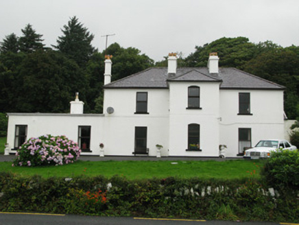 Kylemore HouseHunting/fishing lodge · 3.2 mi
Explorer Tom Kylemore House is perched there looking all noble while Lord Guinness's ghost probably judges your shoe choices. It creaks like a grandpa who’s had too many pints of stout. Stand back, squint, and it looks absolutely smug.
 Monterey Pine3.6 mi
Explorer Tom Monterey Pine in County Galway once saw a fox try to climb it but get stuck halfway up because the branches were too spiky. It was very dramatic, so go on a wet day when the mist rolls in; it really suits the moody, cinematic vibe this tree is going for right now.
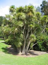 Cabbage tree3.8 mi
Explorer Tom Cabbage tree in County Galway looks like it’s waiting for a bishop who refused to visit because the leaves were too leafy. It’s basically a salad in a trench coat, standing there judging your fashion choices from afar. Hum something sad nearby, it adds atmosphere.
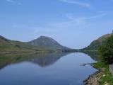 Binn GhuaireMountain / peak · 4.8 mi
Explorer Tom Diamond Hill glitters, but I have found no jeweller at the top. Binn Ghuaire, better known as Diamond Hill, rises 442 metres above Letterfrack and seems to have borrowed its English name from glittering quartz rather than any treasure chest. Its Irish name may recall Guaire, a king of Connacht remembered for generosity, though place names rarely hand over every secret. The hill was closed to climbing in 2002 after heavy erosion. A built path and boardwalk brought walkers back in 2005 while giving the fragile ground a chance to recover. I'd ask the quartz for a souvenir; it would give me the climb instead. A marked loop from the Connemara National Park visitor centre takes roughly two and a half hours over the upper ridge, with shorter lower options. Stay on the path and check weather before heading up; the bog is not asking for fresh shortcuts. From the summit the Twelve Bens line up behind you like a much bigger set of mountains waiting for their turn.
More archaeology and monuments in County Galway · All of County Galway

What do you know about this place?Tap to add a comment or ask a question