
What is recorded here
In wet grassland on a S-facing slope of rising ground in upland region with good views in all directions. Enclosure (TS055-058----) 220m to the N. Moated site consists of a slightly raised square-shaped area (int. dims. 30m NW-SE; 30m NE-SW) enclosed by a poorly preserved earthen bank (top Wth 2m; base Wth 5m; int. H…
Read the whole record
From the National Monuments Service (Archaeological Survey of Ireland) record TS055-059
Places near here
Photo credits
- Maker not stated on source page, en.wikipedia.org
- Algirdas at Lithuanian Wikipedia, Wikimedia Commons · Public domain
- National Inventory of Architectural Heritage
- This Photo was taken by Wolfgang Moroder . Feel free to use my photos, but please mention me as the author and send me a message . This image is not in the public domain . Please respect the copyright protection. It may only be used according to the rules mentioned here. This specifically excludes use in social media , if applicable terms of the licenses listed here not appropriate. Please do not upload an updated image here without consultation with the Author. The author would like to make corrections only at his own source. This ensures that the changes are preserved. Please if you think that any changes should be required, please inform the author. Otherwise you can upload a new image with a new name. Please use one of the templates derivative or extract ., Wikimedia Commons · CC BY-SA 3.0
- Maker not stated on source page, tr.pinterest.com
- Kmcnamee, Wikimedia Commons · CC BY-SA 4.0
- Maker not stated on source page, www.dreamstime.com
- Maker not stated on source page, ru.pinterest.com
- Maker not stated on source page, archaeologymag.com
 Enclosure in IslandsEnclosure · 1670 yd
Explorer Tom Enclosure in Islands is flat as a pancake and totally lost, like it forgot where it parked itself in the grassland.…
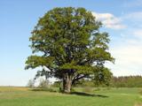 Pedunculate Oak1.2 mi
Explorer Tom This Pedunculate Oak in County Tipperary smells like old rain and forgotten secrets, according to Tom who has sniffed…
 Islands BridgeBridge · 1.2 mi
Explorer Tom Islands Bridge in Ballydonnell is absolutely sick of being asked if it’s made of cheese, even though the rubble…
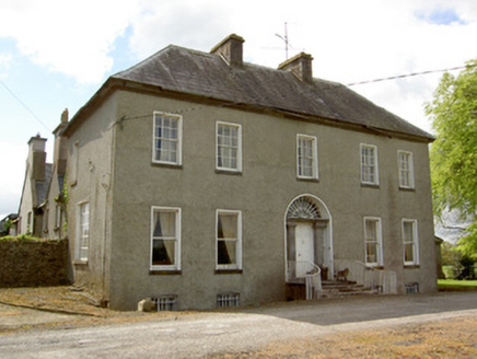 Harleypark HouseCountry house · 1.3 mi
Explorer Tom Harleypark House is a country estate with a gate lodge and outbuildings that make it feel like a whole little village…
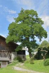 Black Locust1.3 mi
Explorer Tom Black Locust in County Tipperary thinks the local rabbits are just trying to eat their way into the royal court…
 Modesill Castle (in ruins)Castle, tower house · 1.7 mi
Explorer Tom Modesill Castle is an unusually long tower house that looks like it stretched out in bed and never quite got back up. I…
 Lismalin ChurchChurch/chapel · 2.0 mi
Explorer Tom Lismalin Church is basically a tower that forgot the rest of the building was supposed to show up. It’s got a…
 Lismalin Castle (in Ruins)Castle, tower house · 2.1 mi
Explorer Tom Lismalin Castle got lost looking for the Vikings because they went left instead of right and ended up in Wales by…
 O'Sullivan Park, BallingarryGAA ground · 2.5 mi
 Isertkieran CemeteryGraveyard · 4.3 mi
Explorer Tom Isertkieran Cemetery has hidden messages in its stones that are just really bad puns about rocks, dirt, and being…
 Kildowney GraveyardGraveyard · 4.6 mi
Explorer Tom A blackbird has set up permanent residence at Kildowney Graveyard and refuses to leave despite the noise complaints…
 Fairy fort / earthen ringfort in Corbally (drangan)Fairy fort / earthen ringfort · 5.3 mi
Explorer Tom Fairy fort / earthen ringfort in Corbally was once run by a matchmaker who used the wide fosse as a dramatic backdrop…
More archaeology and monuments in County Tipperary · All of County Tipperary

What do you know about this place?Tap to add a comment or ask a question