
What is recorded here
From the National Monuments Service (Archaeological Survey of Ireland) record WM003-048
Places near here
Photo credits
- Mike Searle, Geograph · CC BY-SA 2.0
- National Inventory of Architectural Heritage
- Maker not stated on source page, letsgowiththechildren.co.uk
- Maker not stated on source page, commons.wikimedia.org
- Maker not stated on source page, www.pinterest.com
- Maker not stated on source page, uk.pinterest.com
- Maker not stated on source page, www.dreamstime.com
- Britishfinance, Wikimedia Commons · CC BY-SA 4.0
 Hilltown HouseCountry house · 298 yd
Explorer Tom Hilltown House in Hilltown makes a spooky creaking noise at night that sounds exactly like a giant stretching its legs.…
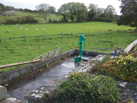 water pump758 yd
Explorer Tom Water pump in Hilltown would tell Saint Patrick that his leprechauns need to learn some basic plumbing skills before…
 Fairy fort / ringfort in TonashammerFairy fort / ringfort · 819 yd
Explorer Tom Fairy fort in Tonashammer vanished so thoroughly that even the mapmakers gave up and went home for tea. A fox probably…
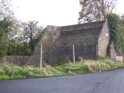 handball alley874 yd
Explorer Tom Handball alley in Templanstown started because two lads got a bit too friendly with the whiskey and bet on whether a…
 Earthwork in Templanstown (hilltown Ed)Earthwork · 1237 yd
Explorer Tom Earthwork in Templanstown smells like wet grass and regret, according to Tom’s very scientific assessment. It’s a…
 Fairy fort / earthen ringfort in Annagh (fore By.)Fairy fort / earthen ringfort · 1300 yd
Explorer Tom Annagh Fairy Fort would tell your boss it needs more flexibility during a job interview. It sits on a hillock right…
Fairy fort / earthen ringfort in TonashammerFairy fort / earthen ringfort · 1328 ydExplorer Tom Fairy fort in Tonashammer is basically a giant mud pie that got rained on twice. Two lads probably bet their last…
 Church in BallymanusChurch · 1597 yd
Explorer Tom Church in Ballymanus was haunted by a fiddler who played the same three notes all night long until he gave up. The…
 Ballycomoyle National SchoolSchool · 1.3 mi
Explorer Tom Ballycomoyle National School is incredibly proud of its one thing, which is being the only building in Raheen More with…
 Mapped graveyardGraveyard · 1.7 mi
Explorer Tom Mapped graveyard in County Westmeath is the favorite gossip spot for the local seagulls, who spend all day perched on…
 Mullaghmeen ForestPicnic place · 2.0 mi
Explorer Tom Mullaghmeen Forest’s name basically means “The Hill Where The Sheep Went To Die” if you squint really hard at the map.…
 Foyran GraveyardGraveyard · 2.4 mi
Explorer Tom Foyran Graveyard in County Westmeath has a family tree that is ninety percent made up, but the stones don’t care…
More archaeology and monuments in County Westmeath · All of County Westmeath

What do you know about this place?Tap to add a comment or ask a question