
What is recorded here
In tillage field atop high ground with good views in all directions in upland region, nearby church (TS055-067001-) and graveyard (TS055-067002-) 100m to the N. Slightly raised square-shaped area (approx dims. 32m N-S; 30m E-W) enclosed by a well-preserved earth and stone bank (top Wth 2m; base Wth 4m; int. H 1m; ext.…
Read the whole record
From the National Monuments Service (Archaeological Survey of Ireland) record TS055-068
Places near here
Photo credits
- National Inventory of Architectural Heritage
- Maker not stated on source page, commons.wikimedia.org
- Maker not stated on source page, en.wikipedia.org
- Maker not stated on source page, www.pinterest.com
- Mike Searle, Wikimedia Commons · CC BY-SA 2.0
- Maker not stated on source page, www.tripadvisor.com
 Lismalin ChurchChurch/chapel · 99 yd
Explorer Tom Lismalin Church is basically a tower that forgot the rest of the building was supposed to show up. It’s got a…
 Church (in Ruins)Church · 99 yd
Explorer Tom Church in Lismalin is standing firm on that slope like it's got nothing to lose. Everyone says it should have crumbled…
 Lismalin Castle (in Ruins)Castle, tower house · 634 yd
Explorer Tom Lismalin Castle got lost looking for the Vikings because they went left instead of right and ended up in Wales by…
 Islands BridgeBridge · 1623 yd
Explorer Tom Islands Bridge in Ballydonnell is absolutely sick of being asked if it’s made of cheese, even though the rubble…
 Enclosure in IslandsEnclosure · 1.1 mi
Explorer Tom Enclosure in Islands is flat as a pancake and totally lost, like it forgot where it parked itself in the grassland.…
 WillmountOutbuilding · 1.5 mi
Explorer Tom Willmount is definitely run by a dog who thinks he’s the architect. It’s got those curved bits and old stable arches…
 Enclosure in Ballyvoneen (modeshil Par.)Enclosure · 1.6 mi
Explorer Tom Enclosure in Ballyvoneen has a serious grudge against the rain because it keeps washing away its personality and…
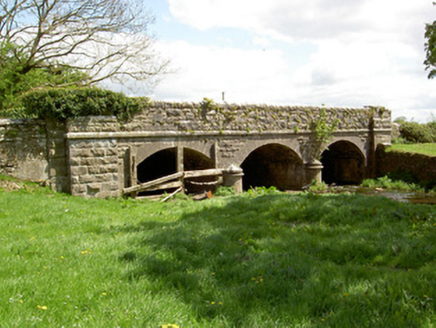 Wilford BridgeBridge · 1.6 mi
Explorer Tom Wilford Bridge in Shangarry was built by a mason who was definitely thinking about lunch while cutting those rocks. The…
 Killaghy CastleCountry house · 2.1 mi
Explorer Tom Killaghy Castle is playing dress-up with fake turrets and crenellations, pretending to be a medieval fortress when it’s…
 St. Michael's CemeteryCemetery · 2.1 mi
Explorer Tom St. Michael's Cemetery was allegedly designed by a mother-in-law who wanted to see exactly how much space her…
 Crohane Castle (in Ruins)Castle, unclassified · 2.4 mi
Explorer Tom Crohane Castle is where Vikings got lost looking for a round tower and ended up in the wrong field entirely. They…
 Inscribed stone (present location) in Knockroe (drangan Par.),knockuraghInscribed stone (present location) · 2.7 mi
Explorer Tom Inscribed stone in Knockroe, Knockuragh is wedged into a bridge like a brick in a chimney that’s been there since the…
More archaeology and monuments in County Tipperary · All of County Tipperary

What do you know about this place?Tap to add a comment or ask a question