
What is recorded here
Situated on a slight NE-facing slope. This is a circular, flat-topped and grass-covered mound of earth (diam. of top 13m N-S; diam. of base 36m N-S; H 4.2m at N to 7m at S). There is no visible bailey but there could be a wide, shallow fosse around the base.
The above description is derived from the published 'Archaeological Inventory of County Meath' (Dublin: Stationery Office, 1987). In certain instances the entries have been revised and updated in the light of recent research.
Date of revised upload: 9 April 20189
A local castle; wider significance not recorded.
The monument record does not grant public access. Check the route and ask the landowner before entering private land.
- What survives
- Recorded monument
Places near here
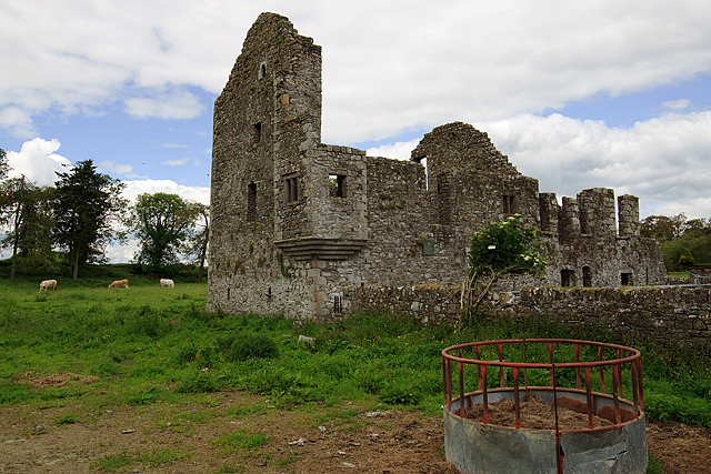 IndicatedHouse, fortified house · 198 yd
 Bawn in Robertstown (kells Lower By.)Bawn · 200 yd
 Church in Robertstown (kells Lower By.)Church · 304 yd
 CrossCross, Churchyard cross · 1280 yd
 Concentric enclosure in Cruicetown (kells Lower By.)Concentric enclosure · 1419 yd
 Owenroe and Moynalty DrainageMemorial · 1.0 mi
 Cherburg WoodForest · 1.9 mi
 Rathmanoo Fox CovertWood · 2.0 mi
 Kiln in Altmush (morgallion By.)Kiln · 2.2 mi
 GravelstownMountain / peak · 2.5 mi
 UghtyneillMountain / peak · 2.5 mi
 Nobber GreenwayMemorial · 2.8 mi
Other information
Photo: Credit not shown in the picture search · Rights wording not checked; contact us if this picture should be removed