
What is recorded here
Slieve Breagh is an ENE-WSW ridge (L of summit c. 500m) that is part of an NE-SW line of hills which extends from Rathkenny, Co. Meath almost to Dunleer, Co. Louth (L c. 15km). There are a number of summit ridges with high cols between them. Breagh is derived from Brega (the heights) which is also the name of the…
Read the whole record
From the National Monuments Service (Archaeological Survey of Ireland) record ME013-051
Places near here
Photo credits
- Maker not stated on source page, www.tripadvisor.com
- Maker not stated on source page, www.alamy.com
- Maker not stated on source page, www.tripadvisor.com.au
- Maker not stated on source page, www.pinterest.com
- National Inventory of Architectural Heritage
- Maker not stated on source page, commons.wikimedia.org
- EecherplazGinkgo06.jpg : Cayambe derivative work: Ginkgotree ( talk ), Wikimedia Commons · CC BY-SA 3.0
- Olivier BEZES, Wikimedia Commons · CC BY 2.5
- Kmcnamee, Wikimedia Commons · CC BY-SA 4.0
- Maker not stated on source page, www.wegow.com
- Maker not stated on source page, www.pinterest.ca
 Fairy fort / earthen ringfort in RathbranchurchFairy fort / earthen ringfort · 53 yd
Explorer Tom The most dramatic thing that ever happened here was a goat falling off the ridge into the grass and screaming like it…
 The Stuck StoneStanding stone · 1208 yd
Explorer Tom The Stuck Stone in Hoardstown had a fox take charge of its little moat one summer, which really threw everyone's plans…
 Standing stone in BallymacanStanding stone · 1619 yd
Explorer Tom Standing stone in Ballymacan would cope on a reality show by leaning slightly to the east. It’s a small round-sectioned…
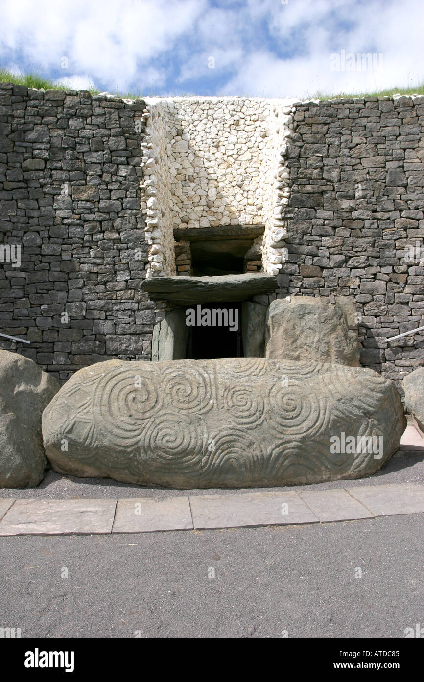
 Passage tomb art in MullagharoyPassage tomb art · 1622 yd
Explorer Tom Passage tomb art in Mullagharoy looks like it was designed by a very angry mother-in-law. The circles are concentric…
 farmyard complex1.3 mi
Explorer Tom Farmyard complex in Dreminstown County Meath is basically just outbuildings having a massive group hug with the…
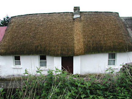 farm house1.3 mi
Explorer Tom Farm house in Dreminstown has a ghost that’s too lazy to haunt it properly, so he just sits in the corner and watches…
 Mapped cemeteryCemetery · 1.7 mi
Explorer Tom Mapped Cemetery refuses to fall down because it’s got a stubborn streak a mile long and a deep fear of being forgotten…
 Ginkgo2.0 mi
Explorer Tom This Ginkgo in County Meath would post photos of its leaves with captions like 'living fossil, no filter needed.' It’s…
 Lebanon Cedar2.0 mi
Explorer Tom This Lebanon Cedar has an ongoing feud with the rain, complaining that it gets in its hair too much. It’s dramatic…
 Rathkenny GAAGAA ground · 2.0 mi
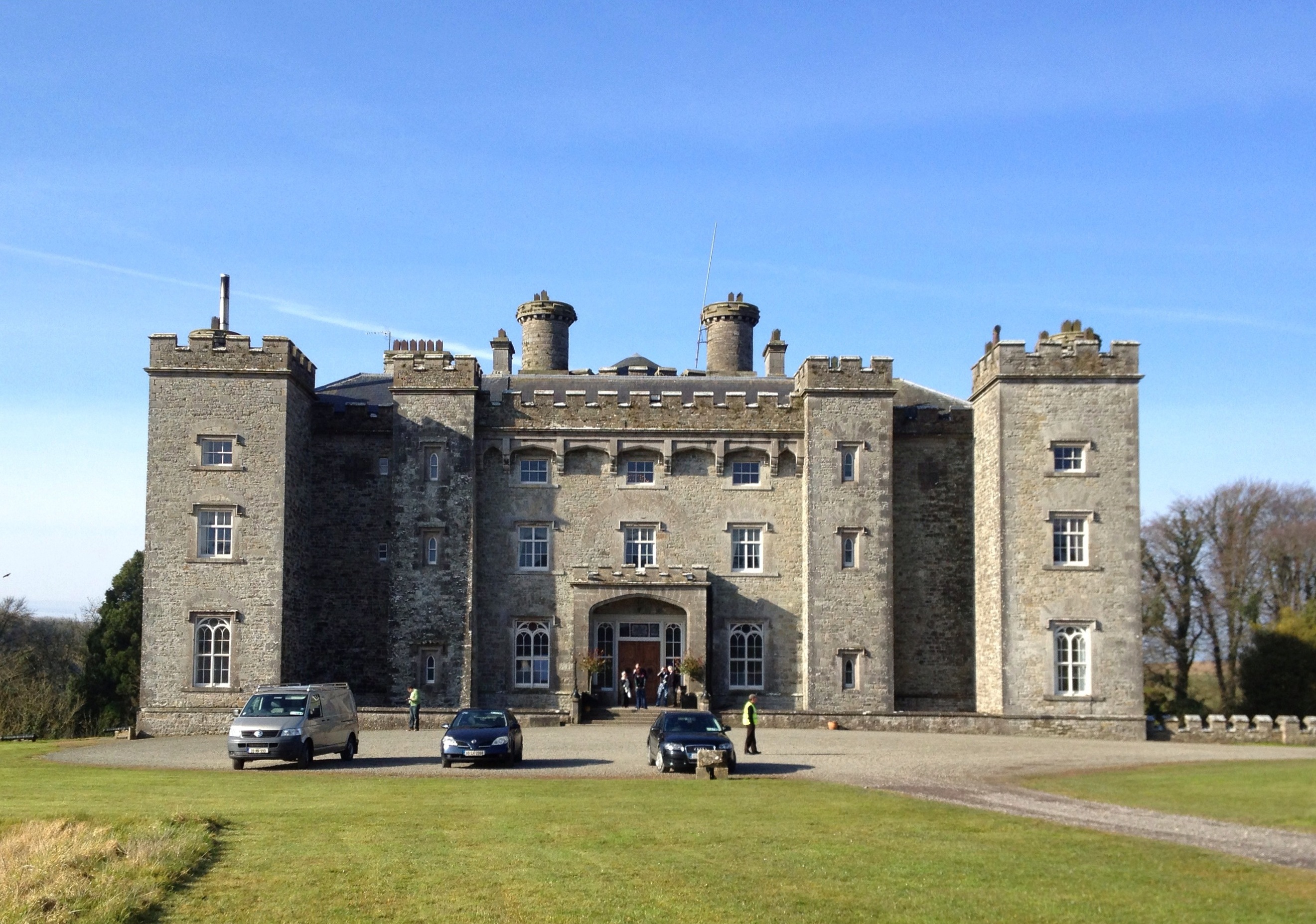 Slane CastlePark · 4.0 mi
Explorer Tom Slane Castle has an escape plan that involves jumping into the lake and swimming away while pretending to be a very…
 Saint Patrick's Church GraveyardGraveyard · 4.3 mi
Explorer Tom Saint Patrick's Church Graveyard in County Meath is still seething because that one bishop refused to visit back in the…
More archaeology and monuments in County Meath · All of County Meath

What do you know about this place?Tap to add a comment or ask a question