What is recorded here
From OpenStreetMap (© OpenStreetMap contributors) w266357351
Places near here
Photo credits
- Maker not stated on source page, www.flickr.com
- JP, Geograph · Creative Commons Attribution-ShareAlike 2.0
- Maker not stated on source page, en.wikipedia.org
- ryaner, The Modern Antiquarian
- Maker not stated on source page, www.pinterest.com
- Rob Hurson, Wikimedia Commons · CC BY-SA 2.0
- Maker not stated on source page, ru.pinterest.com
- National Inventory of Architectural Heritage
- Maker not stated on source page, www.dreamstime.com
- JP, Geograph · CC BY-SA 2.0
- jwd, Geograph · CC BY-SA 2.0
 Fairy fort / ringfort in Curtlestown UpperFairy fort / ringfort · 1523 yd
Explorer Tom Fairy fort in Curtlestown Upper is dressed up in Scots pines like it’s on a reality show, pretending it hasn’t been…
 Saint Patrick's Catholic ChurchChurch/chapel · 1.4 mi
Explorer Tom Saint Patrick’s Catholic Church in Curtlestown Lower sits on a slight rise overlooking the road, which gives it that…
 Holy well in BallyleraneHoly well · 1.4 mi
Explorer Tom Holy well in Ballylerane was nearly sold to a farmer for a horse, but the farmer backed out when he saw how much…
 Prince William's SeatMountain / peak · 1.5 mi
Explorer Tom Prince William's Seat sounds like a throne room with a dress code, but the north Wicklow version is a 555-metre…
 Standing stone in AnnacriveyStanding stone · 1.6 mi
Explorer Tom Annacrivey has a triangular standing stone that the local sheep think is a very boring rock they should be eating more…
 TonduffMountain / peak · 1.6 mi
Explorer Tom Tonduff is Wicklow's answer to a hill that ate the path and then denied everything. The mapped summit sits north of…
 Holy well in AnnacriveyHoly well · 1.6 mi
Explorer Tom Holy well in Annacrivey is a proper matchmaker’s dream, though I suspect the water was more for washing hands than…
 Portal tomb in Glaskenny,onaghPortal tomb · 1.6 mi
Explorer Tom Portal tomb in Glaskenny, Onagh was built on a bargain where someone traded a cow for a big old rock that now leans…
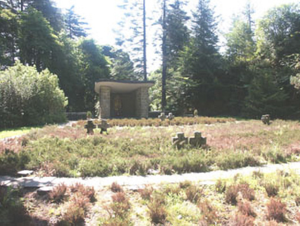 Deutscher Kriegs FriedhofGraveyard/cemetery · 2.1 mi
Explorer Tom Deutscher Kriegs Friedhof in Oldboleys is a German war cemetery where the rabbits probably think they’re in charge of…
 Graveyard in KilmalinGraveyard · 2.2 mi
Explorer Tom Graveyard in Kilmalin thinks it’s fancy because a Cromwell man planted apples there, but honestly? It’d give you a…
 Glencree German War CemeteryHeritage attraction · 2.3 mi
Explorer Tom Glencree German War Cemetery has a family tree that’s mostly made up, with branches that don’t quite connect logically.…
 Source of River LiffeySpring · 2.4 mi
Explorer Tom Source of River Liffey has a prophecy that it would one day flow upwards into the sky to wash the clouds, but it’s…
More woods, forests and old trees in County Wicklow · All of County Wicklow

What do you know about this place?Tap to add a comment or ask a question