
What is recorded here
From the National Monuments Service (Archaeological Survey of Ireland) record WI006-032
Places near here
Photo credits
- National Inventory of Architectural Heritage
- JP, Geograph · CC BY-SA 2.0
- Rob Hurson, Wikimedia Commons · CC BY-SA 2.0
- Colin Park, Geograph · CC BY-SA 2.0
- jwd, Geograph · CC BY-SA 2.0
- Maker not stated on source page, commons.wikimedia.org
- Maker not stated on source page, monumentalireland.ie
- Joe King, Wikimedia Commons · CC BY-SA 3.0
- Sarah777, Geograph · CC BY-SA 2.0
 Lough Bray HouseHunting/fishing lodge · 1430 yd
Explorer Tom Lough Bray House on Powerscourt Mountain is a hunting lodge with such a picture-perfect setting that it looks like it…
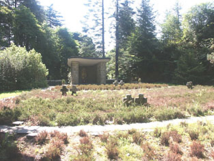 Deutscher Kriegs FriedhofGraveyard/cemetery · 1.0 mi
Explorer Tom Deutscher Kriegs Friedhof in Oldboleys is a German war cemetery where the rabbits probably think they’re in charge of…
 Glencree German War CemeteryHeritage attraction · 1.2 mi
Explorer Tom Glencree German War Cemetery has a family tree that’s mostly made up, with branches that don’t quite connect logically.…
 TonduffMountain / peak · 1.8 mi
Explorer Tom Tonduff is Wicklow's answer to a hill that ate the path and then denied everything. The mapped summit sits north of…
 Tonduff SouthMountain / peak · 1.9 mi
Explorer Tom Tonduff South wants 'Resting Peak' on its tombstone because it refuses to do any heavy lifting for the landscape. The…
 Source of River LiffeySpring · 2.0 mi
Explorer Tom Source of River Liffey has a prophecy that it would one day flow upwards into the sky to wash the clouds, but it’s…
 Noel Lemass MemorialMemorial · 2.6 mi
Explorer Tom Noel Lemass Memorial in County Dublin marks where a captain died in 1923 so the republic might live. That is very…
 Bullaun stone in Glassamucky MountainBullaun stone · 2.8 mi
Explorer Tom Bullaun stone in Glassamucky Mountain is a massive boulder marking a townland boundary. It's got three hollows, like…
 Portal tomb in CunardPortal tomb · 3.0 mi
Explorer Tom Portal tomb in Cunard. Called the 'Shed Stone' by locals, but it’s really just a massive boulder balancing on two…
 Fairy CastleArchaeological place · 4.0 mi
Explorer Tom Fairy Castle is an archaeological place that sounds like a bedtime story but feels like a headache. It’s somewhere in…
 Pine ForestForest · 4.1 mi
Explorer Tom Pine Forest would order a giant chipper portion and ask for extra ketchup to go with its own needles, which is probably…
 Calbeck CastleRuins · 4.4 mi
Explorer Tom Calbeck Castle is a ruin that forgot to tell anyone it was leaving. It’s all rubble and regret near Kilmashogue. If you…
More archaeology and monuments in County Wicklow · All of County Wicklow

What do you know about this place?Tap to add a comment or ask a question