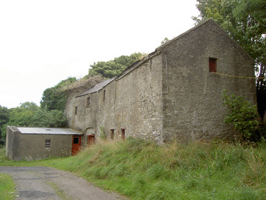
What is recorded here
Detached multiple-bay two-storey corn mill complex on skewed plan (with three adjoining blocks), built c. 1800 and altered c. 1860, having mill wheel with iron and timber fittings to north elevation and single-storey extension to west elevation. Formerly also in use as a brewery. Now disused. Pitched slate multiple-level/stepped roofs with some cast-iron rainwater goods. Corrugated-metal roof to extension. Roughcast rendered over rubble stone and roughly coursed dressed limestone walls. Square-headed window openings with timber sash windows or timber battened fittings. Square-headed door opening to the west set in segmental-headed blind recess with timber battened door. Detached single-storey with attic level outbuilding to west, built c. 1800. Roof absent. Roughly coursed dressed limestone walls. Round-headed opening to north gable end having red brick voussoirs. Detached outbuilding to northwest, built c. 1890, having lean-to corrugated-metal roof and random rubble limestone walls. Segmental-headed door opening having dressed limestone voussoirs and double leaf timber battened doors. Complex located southwest of Granard, with millstream running northeast to southwest through site before joining tributary of the Camlin River.
This impressive corn mill complex retains robust and attractive mill buildings and, more unusually, a mill wheel. The location of industrial mills was generally determined by the availability of water and this structure is sited close to the upper stage of the River Rhine, a tributary of the river originally forming its mill stream. The corn mill provided a basic service to local farmers in grinding and milling their corn, and was also an important source of employment for the local community. In the early nineteenth century this site appears to have been used for brewing and distilling purposes also (Ordnance Survey first edition six-inch map). The remaining structures on this site, including a possible former miller's house (13401019) to the north-west, form a pleasant group in the landscape and represent an important part of the social and architectural heritage of the area.
This does not grant access. Most recorded buildings are privately owned; view them only from public ground unless the owner allows entry.
Places near here
 BarrowBarrow, pond barrow · 502 yd
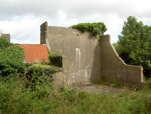 handball alleyhandball alley · 872 yd
 Church in GranardkillChurch · 1488 yd
 Site of Old Town of GranardSettlement deserted, medieval · 1631 yd
 Moat of GranardCastle, motte and bailey · 1.5 mi
 CastleCastle, unclassified · 1.5 mi
 Granard MotteMotte-and-bailey castle remains · 1.5 mi
 1798 Monumentmonument · 1.6 mi
 Clonfin Ambush MemorialMemorial · 2.1 mi
 Cloonfin WoodForest · 2.6 mi
 InchmoreIslet · 4.1 mi
 Derrycassan WoodsWood · 4.2 mi
Other information
Photo: National Inventory of Architectural Heritage · Website use allowed for educational or private purposes with source credit