What is recorded here
National Monument No. 263. William Ó Fearghail (O’Farrell) is recorded as having built a ‘castle’ at Granard in 1405 (Ó hInnse 1947, 175). This castle was taken by English forces in 1420 who soon after abandoned it. The annals note that O’Farrell ‘demolished it for fear of their occupying it again’ (Ann. Conn., 455). A castle at Granard is mentioned in grants to Francis Shane in 1593 (Cal. pat. rolls Ire., Eliz.) and in 1608 (Pat. rolls Ire., Jas I, 499-500), and this is probably the same castle that is noted in the list of lands surrendered to the Crown in 1619 (ibid., 452). An early 17th-century map of Granard barony (BL, Cotton MS Augustus I.i.47) depicts a castle standing on top of the hill at Granard in the area where the motte and bailey (LF010-080001-) are located. Some remains clearly survived into the 19th century as O’Donovan records: that ‘It is said that this moat was opened about fifty years ago, and that the arched vaults of a castle were found within it, built of beautiful square stones, which were well cemented with lime and sand mortar’ (AFM vol. 3, 388-9). The grass-covered remains of this castle can still be seen at the base of the SE side of the motte where a short stretch of walling, 2–3 courses high, has been recorded (Bradley et al. 1985, 18).
National Monument No. 263. William Ó Fearghail (O’Farrell) is recorded as having built a ‘castle’ at Granard in 1405 (Ó hInnse 1947, 175). This castle was taken by English forces in 1420 who soon after abandoned it. The annals note that O’Farrell ‘demolished it for fear of their occupying it again’ (Ann. Conn., 455). A castle at Granard is mentioned in grants to Francis Shane in 1593 (Cal. pat. rolls Ire., Eliz.)…
From the National Monuments Service (Archaeological Survey of Ireland) record LF010-080004
The monument record does not grant public access. Check the route and ask the landowner before entering private land.
- What survives
- Recorded monument
Places near here
 Granard MotteMotte-and-bailey castle remains · 21 yd
 Moat of GranardCastle, motte and bailey · 33 yd
 Saint Mary's Catholic ChurchChurch/chapel · 100 yd
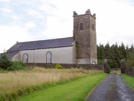 Saint Patrick's Church (Granard)Church/chapel · 160 yd
 1798 MonumentMonument · 169 yd
 Sheela-na-gig in AbbeylaraSheela-na-gig · 2.3 miCartronfreeMountain / peak · 3.1 miClonfin Ambush MemorialMemorial · 3.6 miCloonfin WoodForest · 3.9 mi
 Myles O'Reilly MonumentMemorial · 4.6 mi
 Coolamber CastleHouse, fortified house · 4.6 mi
 Portal tomb in AghnacliffPortal tomb · 6.4 mi
Pictures: 2ManyCats4Me, Wikimedia Commons · CC0; Granard Motte.png : Smcq Derivative work: Hogweard, Wikimedia Commons · CC BY-SA 3.0; Eric Jones, Geograph · Creative Commons Attribution-ShareAlike 2.0; National Inventory of Architectural Heritage; Gillaween, Wikimedia Commons · CC BY-SA 4.0; Cavanphotography, Wikimedia Commons · CC BY-SA 4.0; Charles T. G. Clarke, Wikimedia Commons · CC BY-SA 4.0; Wanfried-Dublin, Wikimedia Commons · CC BY-SA 4.0
More castles and forts in County Longford · All of County Longford
What do you know about this place?