What is recorded here
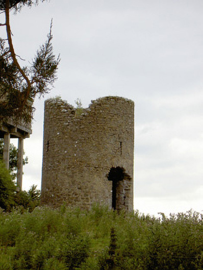
The Mill at Knock stands on its rise with two doorways and no sails. The wind can now stroll straight through the business it used to run, like a retired manager arriving at eleven to tell everyone they’re doing it wrong.
Remains of windmill on circular-plan, built c. 1750. Constructed with rubble limestone with remains of lime render over. Remains of two doorways, one to the south face and one to the north face. Three narrow loop-like openings to each face. Opening/niche/possible fireplace to the interior at first floor/second stage level having stone lintel over. Located on top of a small rise to the southeast of Lanesborough.
This conspicuous ruined former windmill (corn) stands proudly on an elevated site to the southeast of Lanesborough. It is one of a number of windmills along the east/northeast shores of Lough Ree and environs (there is another windmill at Elfeet (13402109) to the south). It was extant and in use by 1764. Although out of use for a considerable period of time (marked as 'in ruins' in 1912), it remains a local landmark, adding historical interest to the local landscape. It is an interesting addition to the industrial heritage of County Longford and acts as an historical reminder of the great boom experienced in the Irish milling industry during the mid-to-late eighteenth century.
From the Buildings of Ireland (National Inventory of Architectural Heritage) record 13310006
This does not grant access. Most recorded buildings are privately owned; view them only from public ground unless the owner allows entry.
Places near here
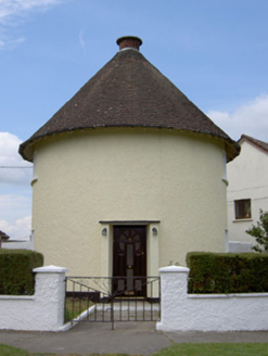 The Round HouseWorker's house · 453 yd
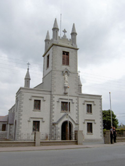 Catholic Church of the Blessed Lady of the RosaryChurch/chapel · 461 ydCommons North WalkVisitor information · 708 ydWild birdsVisitor information · 753 ydWhite Sand WoodWood · 1494 ydBallyclare IslandIslet · 1666 ydIndicatedCrannog · 1.0 mi
 Rathcline CastleHouse, fortified house · 1.3 mi
 Rathcline CastleBawn · 1.3 miIndicatedEnclosure · 1.5 miFerrinchIslet · 3.0 mi
 Slieve BawnMountain / peak · 5.0 mi
Pictures: National Inventory of Architectural Heritage; Mike Searle, Geograph · CC BY-SA 2.0; Kieran Campbell, Geograph · CC BY-SA 2.0; Colin Park, Geograph · CC BY-SA 2.0
More historic places in County Longford · All of County Longford
What do you know about this place?