
What is recorded here
Yes. The second enclosure is the disused one. The first enclosure is still named Military Cemetery on the 1905 map. Both sit beside Fermoy and the barracks. The railway cut through the north-east corner, which means the boundary did not belong only to the living or the dead. It belonged to movement itself.
At NW side of military barracks (15196), on NW side of Fermoy. Subrectangular area (c. 140m NNW-SSE; c. 100m WSW-ENE) enclosed by stone wall. Not shown on 1842 OS 6-inch map; marked 'Military Cemetery' on 1905 OS 6-inch map. North side angled along line of former railway line, which seems to have cut through NE corner of cemetery. Entered through wide gateway with cut limestone piers and arch, at E end of S wall. Interior well-maintained and contains thin scatter of 19th-/early-20th-century military headstones. Adjacent famine burial ground (14581) entered through archway to S. Second enclosure (c. 140m max. NNW-SSE; c. 60m WSW-ENE) to E of cemetery and famine burial ground marked 'Military Cemetery (Disused)' on 1905 OS 6-inch map.
The above description is derived from the published 'Archaeological Inventory of County Cork. Volume 4: North Cork' (Dublin: Stationery Office, 2000). In certain instances the entries have been revised and updated in the light of recent research.
Date of upload/revision: 14 January 2009
The monument record does not grant public access. Check the route and ask the landowner before entering private land.
- What survives
- Recorded monument
Places near here
 IndicatedGraveyard · 119 yd
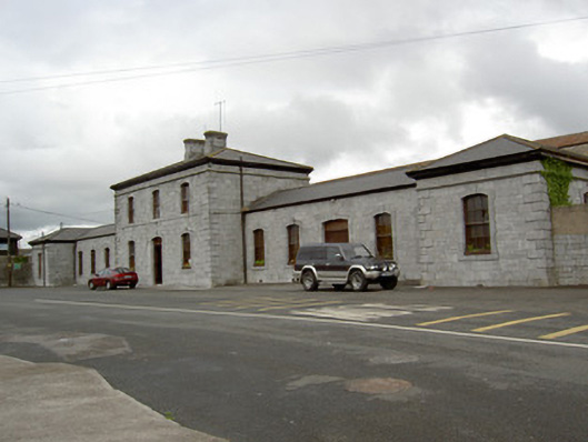 Nelligan's Funeral Homerailway station · 269 yd
 store/warehousestore/warehouse · 315 yd
 St Bernards WellHoly well · 926 yd
 Tourist InformationVisitor information · 1060 yd
 Graveyard in FermoyGraveyard · 1064 yd
 Kent BridgeMemorial · 1105 yd
 Old Railway ViaductViewpoint · 1.2 mi
 Carrigabrick Castle (in Ruins)Castle, tower house · 1.3 mi
 GarraunigerinaghCastle(inRuins) (1936)*Castle, tower house · 1.3 mi
 Ballybrack WoodForest · 1.8 mi
 Strawhall WoodForest · 2.1 mi
Other information
Photo: Credit not shown in the picture search · Rights wording not checked; contact us if this picture should be removed